Islais Creek wetlands
"I was there..."
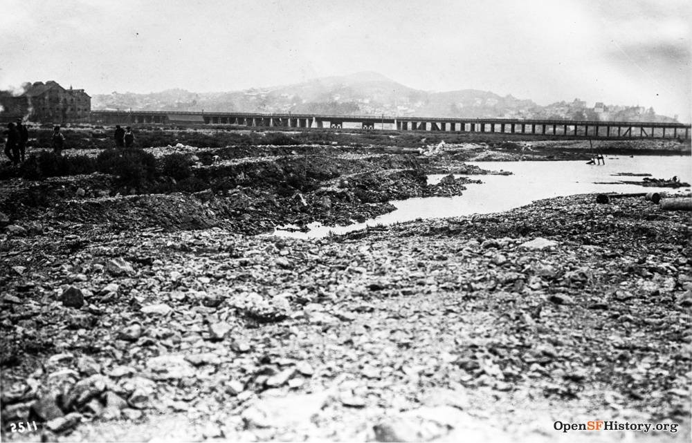
Islais Creek wetlands, once home to many kinds of fish and a favorite place to play and fish for the kids on Bernal Heights. This bridge across Islais Creek is located near Kentucky Street (now 3rd Street), August 23, 1915.
photo: OpenSFHistory / wnp36.00854.jpg
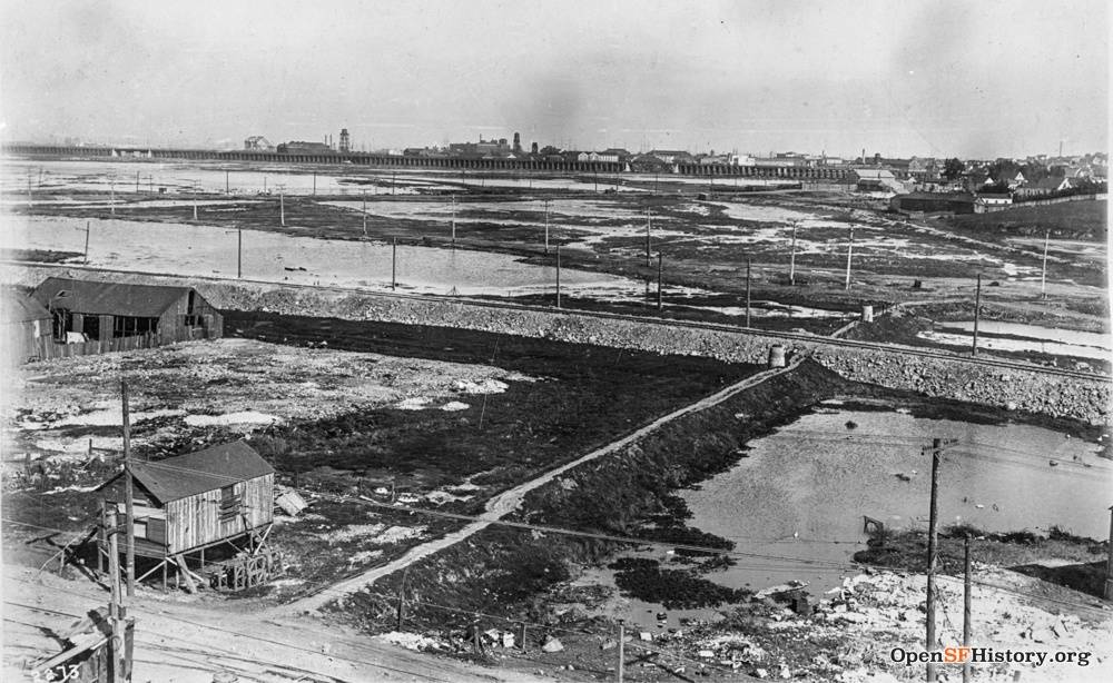
Former Wetlands of Islais Creek seen from Bernal Heights, San Bruno Avenue near Cortland, March 4, 1915
Photo: OpenSFHistory / wnp36.00730.jpg
Islais Creek and its extensive marshes were just outside the initial Two-Cow Limit [imposed by the city in the 1890s to prevent maintaining cow herds within City Limits], making it an ideal location for cows producing milk for urban consumers. As an unclaimed commons, the grasslands around Islais Creek provided a distinctive environment for small-scale dairy farmers seeking close proximity to downtown markets.
Health Department officials decided that “from now on a determined war will be waged against all dairymen who allow their milch cows to feed on swamp lands,” according to the San Francisco Call in December 1895. The wide swath of marshes connected to Islais Creek was chief among these “swamp lands” in San Francisco. It was here that dairymen allowed their cows free range “to wade into the swamp and eat of the rank grass which grows in the infected water.” [In November 1895] health department officials arrived to discover the marshes full of cows—as many as two hundred standing in the swamps, with many more on the nearby slopes, their legs wet or caked with mud.
The vilification of the Italian dairy farmers along Islais Creek occurred in a larger economic and technological context. The small and squalid operations around Islais Creek stood in sharp contrast to a growing market presence of larger, scientifically managed dairy producers. These producers advertised their production methods as modern and sanitary—and an efficient and effective management of nature. By the 1890s, the wealthiest and most successful of the dairies that supplied San Francisco were far from the city center and far from the marginal urban pastures like Islais Creek.
—Excerpted from Animal City: The Domestication of America by Andrew Robichaud, Harvard University Press: 2019
The 3rd Street Bridge over Islais Creek, c. 1920s.
Photo: Online Archive of California
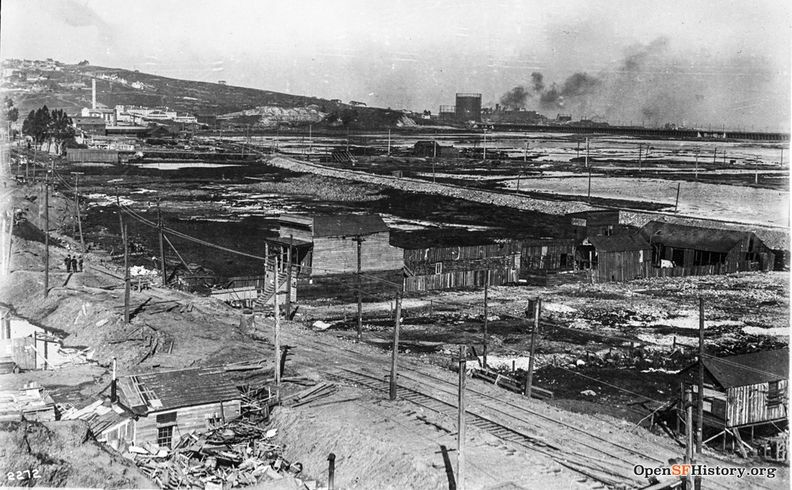
Islais Creek east from Bernal Hill, looking north to Potrero Hill.
Photo: OpenSFHistory.org wnp36.00729; DPW Book 11, DPW 2272
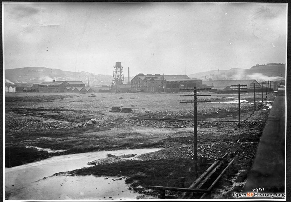
January 25, 1916 view of Islais Creek wetlands following a flood. Location is east of Bernal Heights looking south from the railroad trestle seen in above photo.
photo: OpenSFHistory / wnp36.01165.jpg
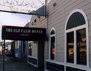
The Old Clam House at Bayshore Blvd. and Oakdale Ave., in place at the edge of the wetlands since the 1860s.
photo: Chris Carlsson
<iframe src="https://archive.org/embed/ssfgwill" width="640" height="480" frameborder="0" webkitallowfullscreen="true" mozallowfullscreen="true" allowfullscreen></iframe>
Lifelong Bernal resident George Williams used to beg for bait at the Old Clam House when he played in the swamps as a kid.

