East Slope Bernal Heights
Unfinished History
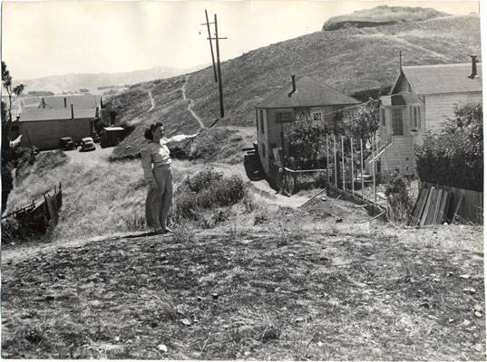
Mrs. William McKeen standing near Franconia Street, 1946.
Photo: San Francisco History Center, San Francisco Public Library
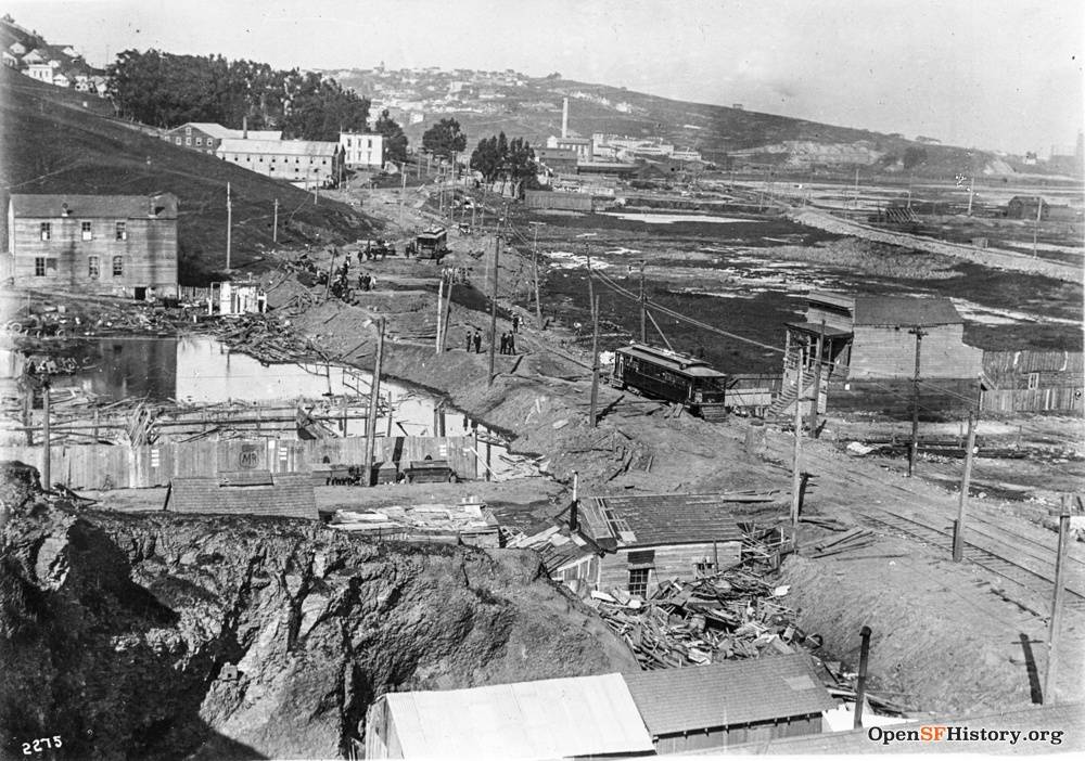
San Bruno and Cortland Ave., 1915, looking north with Bernal Heights rising to the immediate left and Potrero Hill in the distance. Islais Creek wetlands occupy today's Bayshore Blvd. industrial zone. These wetlands also drained Precita Creek, which ran down beneath Army Street on the north side of Bernal Heights. The old H streetcar is visible running along San Bruno Avenue just east of Bernal Hill, just west and above the still un-"developed" wetlands of Islais Creek.
Photo: OpenSFHistory.org wnp36.00732.jpg; DPW Book 11 DPW 2275
[[Image:View East from Bernal Heights (around Holladay Avenue) toward the Islais Creek Incinerator site at Marin and Kansas. June 25 1912 opensfhistory wnp36.00193.jpg|800px]]
View east from Bernal Heights eastern slope (near Holladay Avenue) toward the Islais Creek Incinerator site at Marin and Kansas, June 25, 1912.
Photo: OpenSFHistory.org wnp36.00193
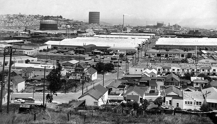
View of Oakdale and Bayshore Boulevard from slopes of Bernal Heights before Highway 101 was built, c. 1950.
Photo: San Francisco Planning Commission archives
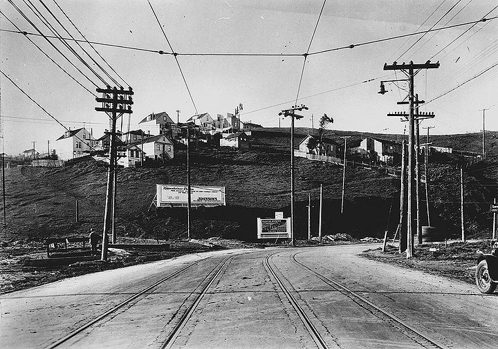
San Bruno Avenue north near present-day Alemany Blvd intersection. Bernal Heights east slope is the hill, 1927.
Photo: San Francisco History Center, SF Public Library
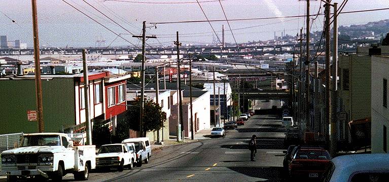
1997 eastern view from Cortland Avenue over today's industrial zone in the former wetlands. The double-decker freeway in the distance is I-280, which predictably suffered structural damage in the 1989 earthquake due to its construction on former bay mudflats.
photo: Chris Carlsson
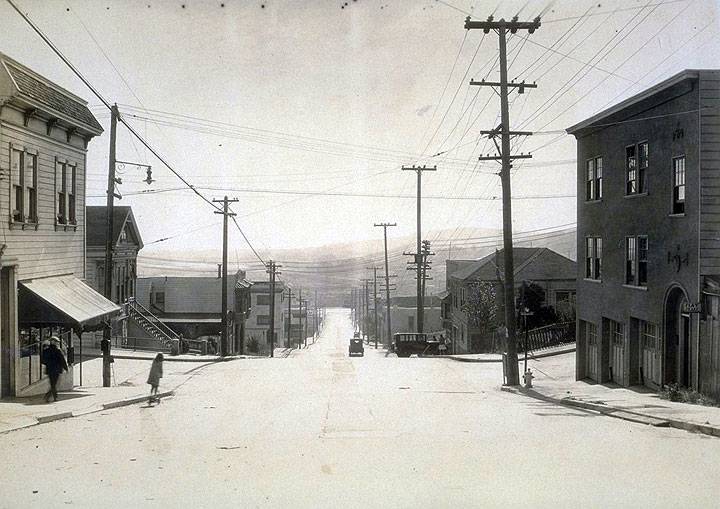
East on Cortland Ave. from Nevada Street, July 31, 1931.
Photo: Jesse Brown Cook collection, online archive of California I0052329A
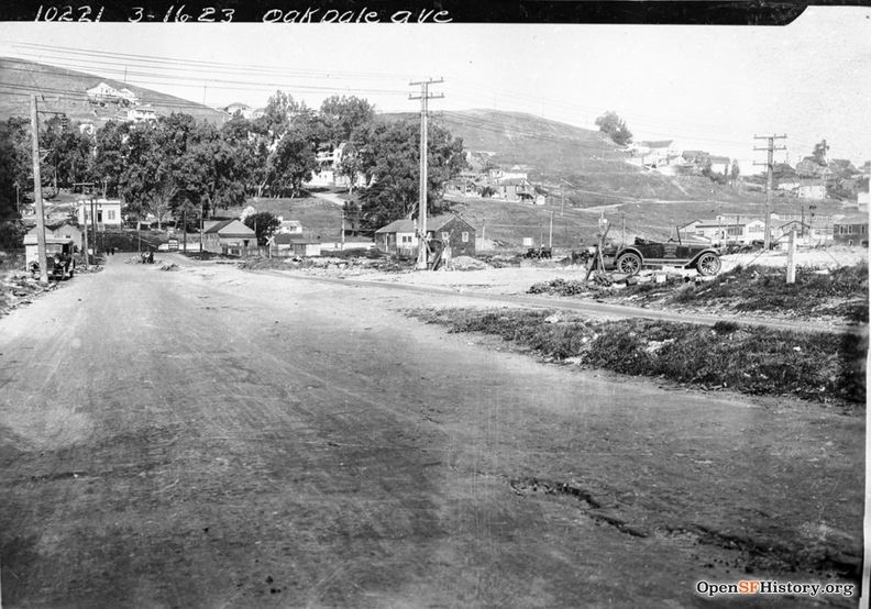
March 16, 1926, view west on Oakdale near Toland. Old Clam House is at intersection of Bayshore (then San Bruno Avenue). Bernal Heights and site of US Highway 101 in background.
Photo: OpenSFHistory.org wnp36.003371; DPW Book 36, DPW 10221
Bayshore and Oakdale, c. 1918, close-up on the Old Clam House restaurant, then the Oakdale Bar.
Photo: OpenSFHistory.org wnp30.0349
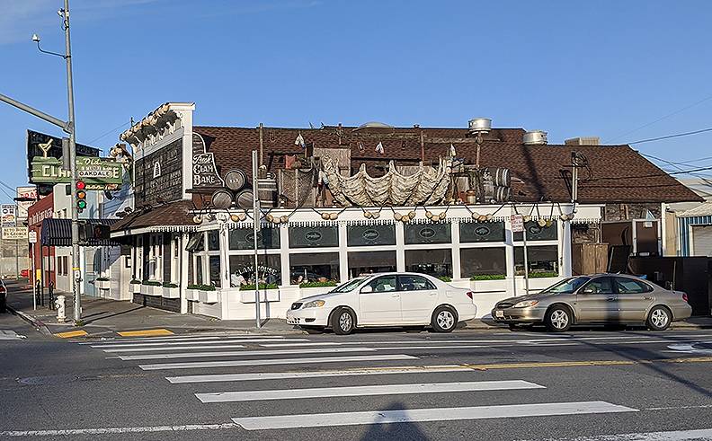
Old Clam House at Bayshore Blvd. and Oakdale, 2020.
Photo: Chris Carlsson
Longer view in 1918 at the Oakdale Bar, later the Old Clam House restaurant.
Photo: OpenSFHistory.org wnp30.1313

