Ships under Financial District: Difference between revisions
mNo edit summary |
mNo edit summary |
||
| Line 5: | Line 5: | ||
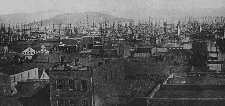
'''Photograph of Yerba Buena Cove in 1851''' | '''Photograph of Yerba Buena Cove in 1851''' | ||
[[Image: | [[Image:Sam Manera map of FiDi submerged ships. 2013.jpg]] | ||
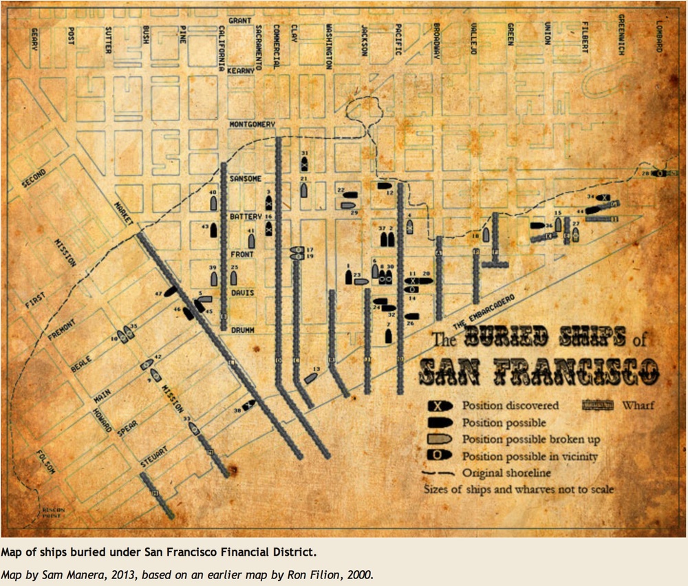
'''Map of ships buried under San Francisco Financial District.''' | '''Map of ships buried under San Francisco Financial District.''' | ||
Revision as of 13:32, 17 April 2023
Unfinished History
Photograph of Yerba Buena Cove in 1851
Map of ships buried under San Francisco Financial District.
Map by Sam Manera, 2013, based on an earlier map by Ron Filion, 2000.
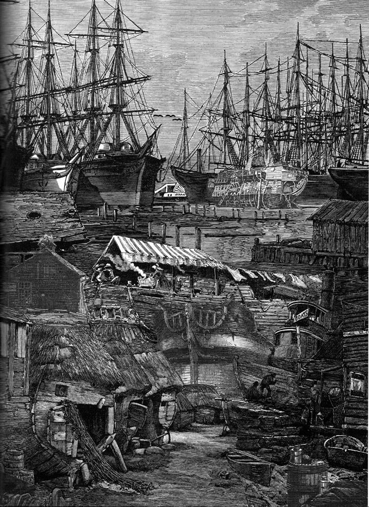
Collage depicting ships piled into Yerba Buena cove by Satty, from "Visions of Frisco" edited by Walter Medeiros, Regent Press 2007
During the height of the gold excitement, there were at least five hundred ships stranded in the harbor, some without even a watchman on board, and none with a crew sufficiently large to work her. Many of these vessels never sailed again. Some rotted away and sank at their moorings. (Herbert Asbury in "The Barbary Coast")
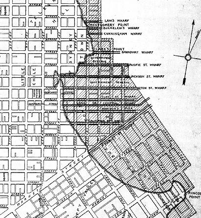
1851 cove map closeup. The shadowed area is roughly the outline of Yerba Buena Cove when the city was founded and there are more than 70 old wooden ships buried in the old cove that is now part of the city.
Ships Under the Financial District
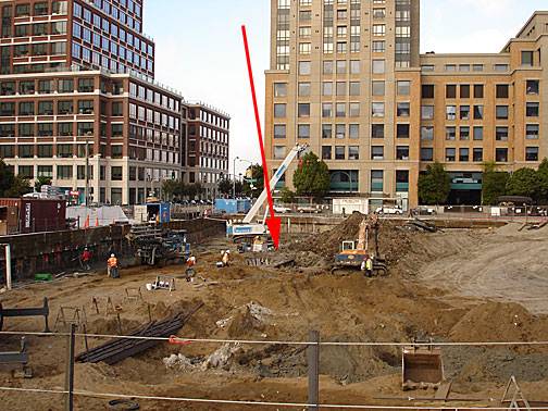
Photo: Chris Carlsson
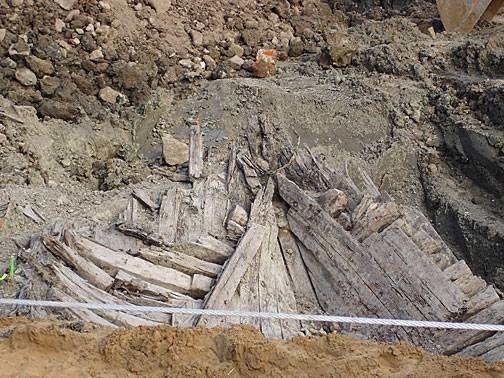
Photo: Chris Carlsson
A ship dug up in 2005 at Spear and Folsom was discovered to be the Candace, an 1830s sailing ship that had found its last anchorage under the growing city.
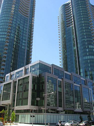
These are the finished buildings on the site above where the Candace was found.
Photo: Chris Carlsson
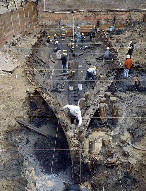
The remains of the General Harrison, found in 2001 under 425 Battery Street at Clay.
Photographer unknown

