Northerly view from Bernal: Difference between revisions
swapped in better SFMTA photo |
added many new OpenSFHistory photos |
||
| Line 6: | Line 6: | ||
''Photo: [http://www.sfmta.com/photo SFMTA U14122]'' | ''Photo: [http://www.sfmta.com/photo SFMTA U14122]'' | ||
[[Image:1938 Looking north from Bernal Heights, with bird flying over skyline wnp27.3301.jpg|792px]] | |||
'''1938 view north from Bernal Heights.''' | |||
''Photo: OpenSFHistory.org wnp27.3301'' | |||
| Line 16: | Line 22: | ||
[http://webapp1.dlib.indiana.edu/cushman/ ''Top: Charles Cushman Collection: Indiana University Archives (P06741)''] ''Bottom Photo: Chris Carlsson, 2009.'' | [http://webapp1.dlib.indiana.edu/cushman/ ''Top: Charles Cushman Collection: Indiana University Archives (P06741)''] ''Bottom Photo: Chris Carlsson, 2009.'' | ||
[[Image:View from Bernal Heights 1973 wnp28.2566.jpg|792px]] | |||
'''View north from Bernal Heights, 1973.''' | |||
''Photo: OpenSFHistory.org wnp28.2566'' | |||
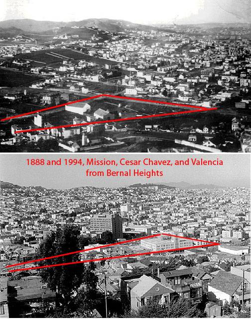
[[Image:Mission-and-chavez-and-valencia-from-bernal-2-up.jpg]] | [[Image:Mission-and-chavez-and-valencia-from-bernal-2-up.jpg]] | ||
''Photos: Private Collection and David Green'' | ''Photos: Private Collection and David Green'' | ||
[[Image:MI58B7~1.JPG|792px]] | |||
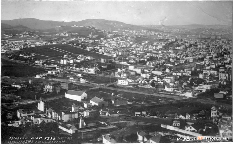
'''Mission District 1888'''—Elevated view northwest from Bernal Heights over the Mission District—St. Luke's Hospital at left, in present location at Valencia and Cesar Chavez—Intersection of Mission and Army (now Cesar Chavez) with a bridge over Precita Creek. | |||
''Photo: OpenSFHistory.org wnp71.2482'' | |||
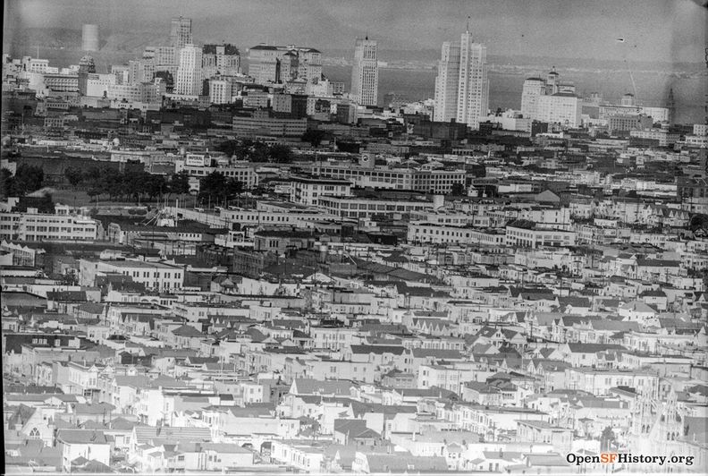
<font size=4>Panoramas taken from Bernal Heights on November 14, 1952</font size> | |||
[[Image:Nov 14 1952 View from Bernal Heights to downtown wnp14.10635.jpg|792px]] | |||
''Photo: OpenSFHistory.org wnp14.10635'' | |||
[[Image:Nov 14 1952 wnp14.10637.jpg|792px]] | |||
''Photo: OpenSFHistory.org wnp14.10637'' | |||
[[Image:Nov 14 1952 flipped wnp14.10640.jpg|792px]] | |||
''Photo: OpenSFHistory.org wnp14.10640'' | |||
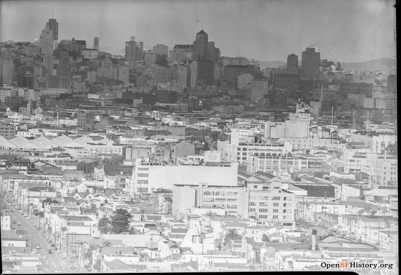
[[Image:Nov 14 1952 Seals Stadium and Hamms wnp14.10636.jpg|792px]] | |||
'''Seals Stadium is visible in center of final image.''' | |||
''Photo: OpenSFHistory.org wnp14.10636'' | |||
[[Banks Street | Prev. Document]] [[Soapbox Society | Next Document]] | [[Banks Street | Prev. Document]] [[Soapbox Society | Next Document]] | ||
Revision as of 21:37, 12 January 2020
Unfinished History
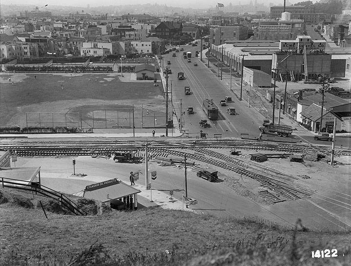
Potrero Ave and Army Street, c. 1920s, looking northward from Bernal Heights
Photo: SFMTA U14122
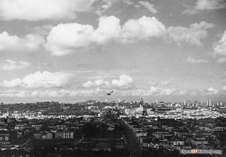
1938 view north from Bernal Heights.
Photo: OpenSFHistory.org wnp27.3301
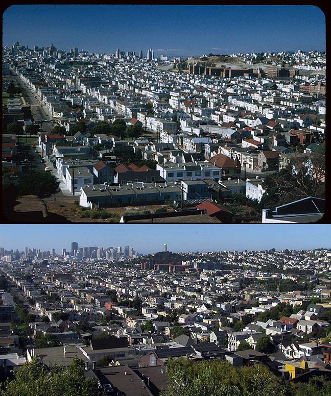
View north/northeast from Bernal Heights Blvd.
Top: July 23, 1953; Bottom: July 6, 2009.
Top: Charles Cushman Collection: Indiana University Archives (P06741) Bottom Photo: Chris Carlsson, 2009.
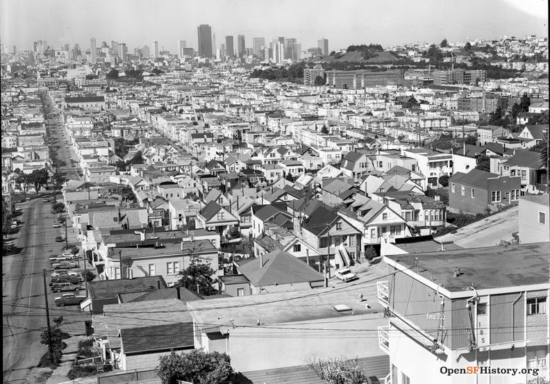
View north from Bernal Heights, 1973.
Photo: OpenSFHistory.org wnp28.2566
Photos: Private Collection and David Green
Mission District 1888—Elevated view northwest from Bernal Heights over the Mission District—St. Luke's Hospital at left, in present location at Valencia and Cesar Chavez—Intersection of Mission and Army (now Cesar Chavez) with a bridge over Precita Creek.
Photo: OpenSFHistory.org wnp71.2482
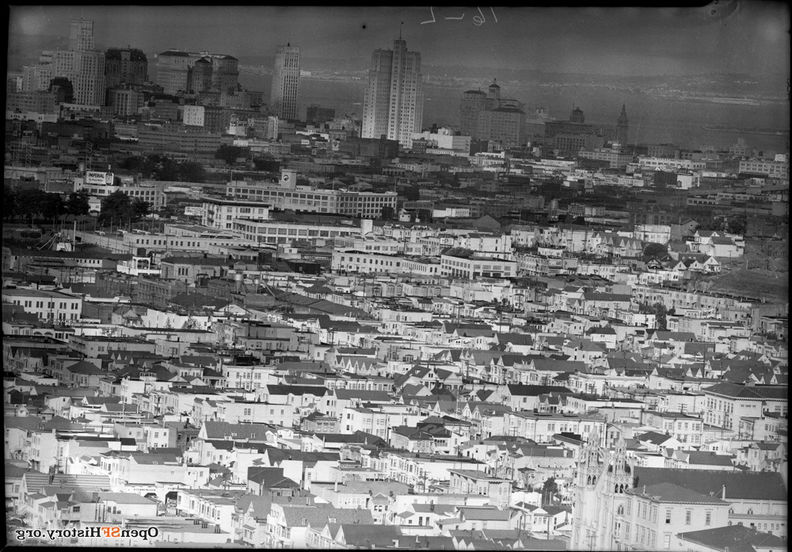
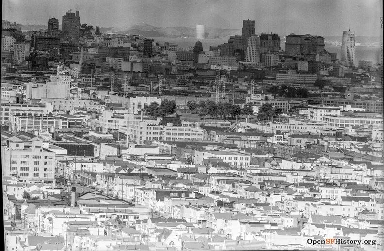
Panoramas taken from Bernal Heights on November 14, 1952
Photo: OpenSFHistory.org wnp14.10635
Photo: OpenSFHistory.org wnp14.10637
Photo: OpenSFHistory.org wnp14.10640
Seals Stadium is visible in center of final image.
Photo: OpenSFHistory.org wnp14.10636

