St Mary's Development: Difference between revisions
fixed navigation for renamed page |
No edit summary |
||
| Line 6: | Line 6: | ||
''Private Collection, San Francisco, CA'' | ''Private Collection, San Francisco, CA'' | ||
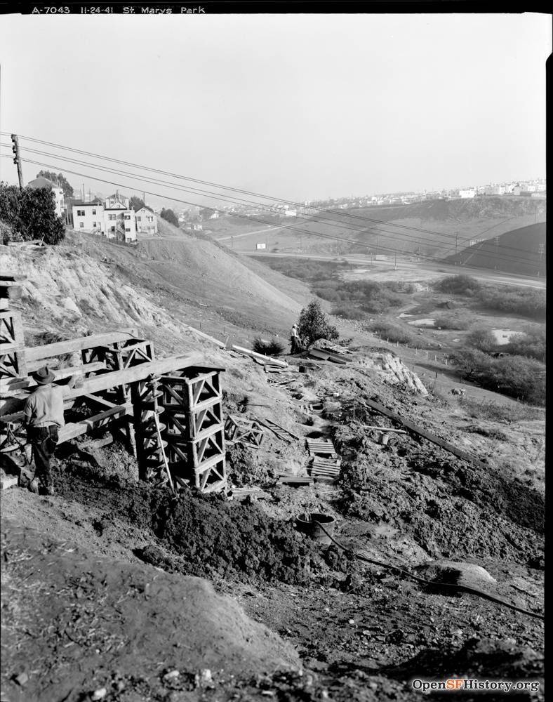
[[Image:Nov 24 1941 View Southeast toward Alemany Boulevard and Silver Terrace from the east edge of St. Mary's Park (St. Mary's Recreation Center) DPW A7043 wnp26.051.jpg]] | |||
'''November 24, 1941: View southeast toward Alemany Boulevard and Silver Terrace from the east edge of St. Mary's Park. Ponds visible at bottom of hill where Alemany Farm is today.''' | |||
''Photo: OpenSFHistory.org, wnp26.051, DPW A7043'' | |||
[[Philosopher's Way at McLaren Park |Prev. Document]] [[Crocker Amazon Tract Notables | Next Document]] | [[Philosopher's Way at McLaren Park |Prev. Document]] [[Crocker Amazon Tract Notables | Next Document]] | ||
[[category:Excelsior]] [[category:1920s]] [[category:Bernal Heights]] | [[category:Excelsior]] [[category:1920s]] [[category:Bernal Heights]] [[category:1940s]] | ||
Revision as of 17:51, 10 January 2020
Unfinished History

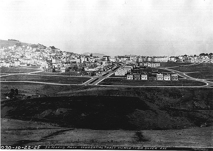
Silver Avenue view: 1925 northeastward towards the new St. Mary's Park residential tract southwest of Bernal Heights
Private Collection, San Francisco, CA
November 24, 1941: View southeast toward Alemany Boulevard and Silver Terrace from the east edge of St. Mary's Park. Ponds visible at bottom of hill where Alemany Farm is today.
Photo: OpenSFHistory.org, wnp26.051, DPW A7043

