India Basin: Difference between revisions
m PC |
m changed from water tour to shoreline tour |
||
| Line 31: | Line 31: | ||
''Photo: Chris Carlsson'' | ''Photo: Chris Carlsson'' | ||
[[Image: | [[Image:Shoreline-tour-button.jpg]] [[India Basin and the Southeast Bayshore|--> Shoreline Tour]] | ||
[[Yosemite Creek |Prev. Document]] [[India Basin and the Southeast Bayshore | Next Document]] | [[Yosemite Creek |Prev. Document]] [[India Basin and the Southeast Bayshore | Next Document]] | ||
[[category:Bayview/Hunter's Point]] [[category:1920s]] [[category:1990s]] [[category:2000s]] [[category:shoreline]] [[category:Water]] | [[category:Bayview/Hunter's Point]] [[category:1920s]] [[category:1990s]] [[category:2000s]] [[category:shoreline]] [[category:Water]] | ||
Revision as of 20:59, 4 January 2009
Unfinished History
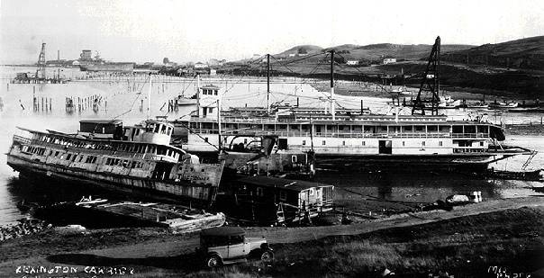
India Basin Shipyards pictured in 1928
Photo: Greg Gaar Collection, San Francisco, CA
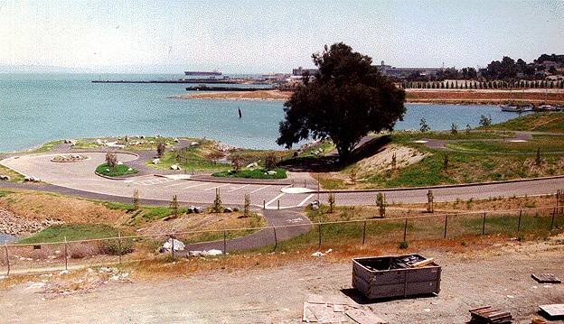
India Basin, pictured here in 1996, where a park was carved out of the industrial shoreline just north of Hunter's Point.
Photo: Chris Carlsson
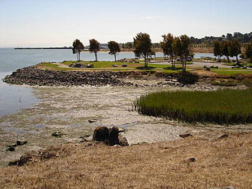
The India Basin park seen in 2005, mudflats and native plants beginning to fill the surrounding waters.
Photo: Chris Carlsson
The southeastern shoreline is also home to a number of indigenous plants and a restored habitat.
Photo: Chris Carlsson
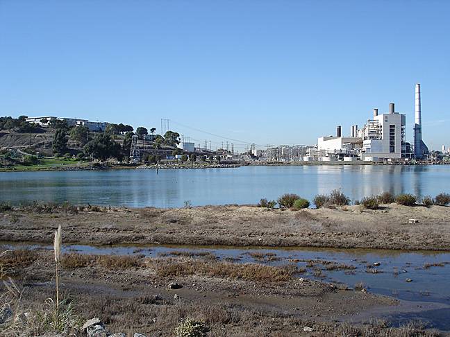
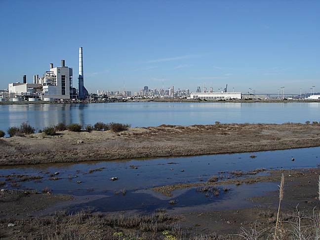
The PG&E Hunter's Point power plant, finally shut down after years of community pressure, on the shoreline in 2007 prior to its deconstruction.
Photo: Chris Carlsson

