Bay Bridge Artery: Difference between revisions
(added photo) |
(added explanation quote) |
||
| Line 106: | Line 106: | ||
''Photo: San Francisco History Center, SF Public Library'' | ''Photo: San Francisco History Center, SF Public Library'' | ||
<blockquote>In the first phase of work in 1960, the San Francisco approaches were reconstructed or newly constructed, the upper deck was strengthened to accommodate truck and bus traffic, and the rail section of the lower deck was paved over. The second phase, which took place in 1961, involved rebuilding the Yerba Buena Island Tunnel and viaducts while strengthening the upper deck. To accomplish this without closing the bridge, the division of highways built a temporary bridge that allowed work to go on while keeping half the tunnel open to traffic. During the final phrase, accomplished in 1962 and 1963, workers strengthened the upper deck on the East Bay crossing, and added new lightweight pavement. The reconstructed decks were opened to unidirectional traffic on October 12, 1963. | |||
The restructure of the Bay Bridge between 1958 and 1963 changed the look as well as the functioning of the structure. Although the bridge retained its essential appearance, the alterations brought the structure into the modern postwar function. No longer was it a quaint multipurpose structure with trains and trucks segregated from automobiles. By 1963 the Bay Bridge was a modernized part of the interstate highway system, carrying I-80 to its western terminus and linking the extensive freeway system on the peninsula with the even more extensive freeway network in the East Bay. | |||
—Stephen D. Mikesell, ''A Tale of Two Bridges: The San Francisco-Oakland Bay Bridges of 1936 and 2013'' (University of Nevada Press: 2017)</blockquote> | |||
Revision as of 14:19, 13 June 2020
Historical Essay
by Chris Carlsson, 2013
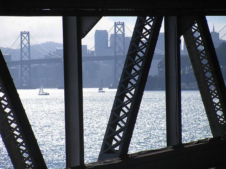
View through old east span of west span of Bay Bridge and downtown San Francisco, September 2013.
Photo: Chris Carlsson
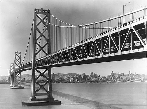
1958 photo of Bay Bridge and San Francisco skyline from Yerba Buena Island.
Photo: Kurt Bank
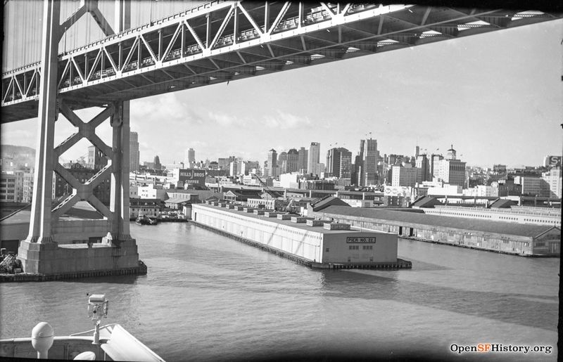
c. 1960 passing Pier 22 and Bay Bridge. Taken from bridge of outbound ship. The Embarcadero Freeway looks completed and the old SP sign (center right edge of image) is still on the Southern Pacific bldg removed, Sept. 1961.
Photo: OpenSFHistory.org wnp14.2055
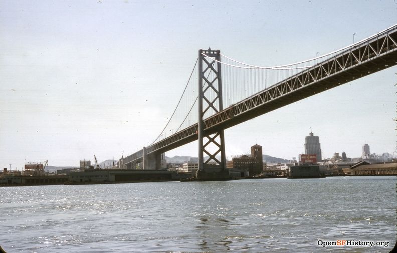
Under the Bay Bridge, 1961, with Hills Brothers coffee and the Pacific Telephone and Telegraph Buildings the most prominently visible at the time.
Photo: OpenSFHistory.org wnp25.5823
"The Bay Bridge, between San Francisco and Oakland, brought far greater damage than benefits to both cities: it pumped up a once unnecessary volume of private traffic between them, at a great expense in expressway building and at a great waste in time and tension, spent crawling through rush-hour congestion. This traffic eventually wiped out, by impoverishment, the excellent rapid transit that had been installed on the Bay Bridge (the Key System) a form of transportation that the citizens of San Francisco have now repentantly voted to restore (the BART system), at an expense far greater than the cost of the original system. The ferry ride across the bay from Oakland was one of the regions greatest recreational resources — an incomparable experience, so exhilarating, at almost any time of the day, that one often sought an excuse for making the journey. It was not a long ride — not more than twenty-five minutes or so, and certainly not longer than the present depressing rush-hour crawl over the bridge." -- Lewis Mumford, 1963
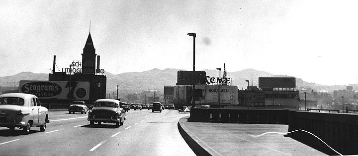
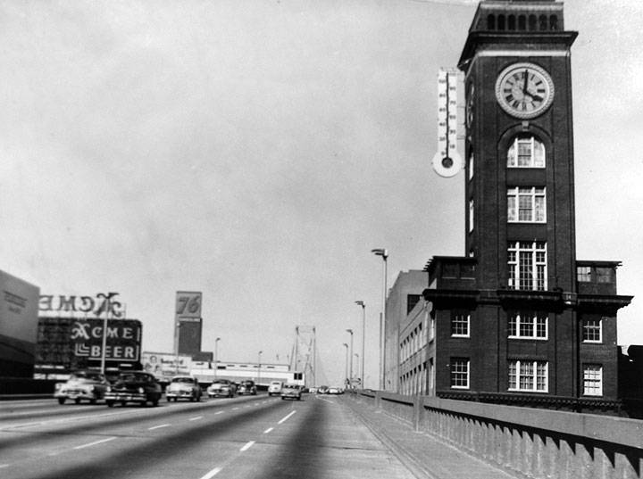
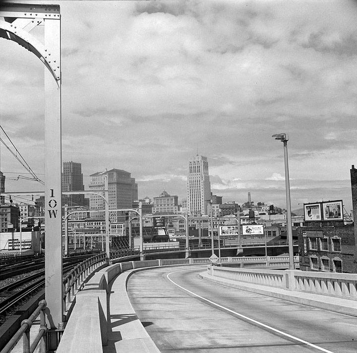
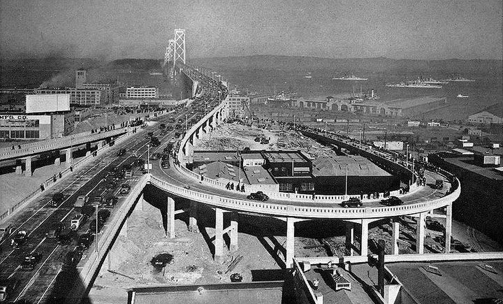
Before the Bay Bridge was linked to the freeway system after 1953 cars got on and off on long cement ramps that hit the city streets on 5th between Harrison and Bryant. In those days car traffic was limited to the top deck, where there were three lanes in each direction.
Photos: San Francisco Planning Commmission archives
San Francisco from the First Street offramp of the Bay Bridge, April 1939.
Photo: Dorothea Lange, Library of Congress
Bay Bridge on opening day 1936 with pedestrians walking on to Bridge, and the six lanes of two-way traffic that characterized the upper decks until the reconfiguration in the early 1960s.
Photo: Phil Davies, via Facebook
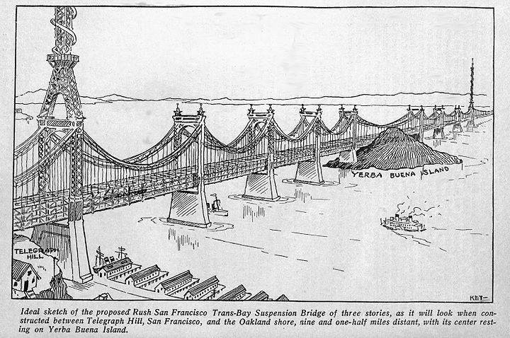
Early 20th century vision of proposed Bay Bridge.
Image: Wikimedia commons
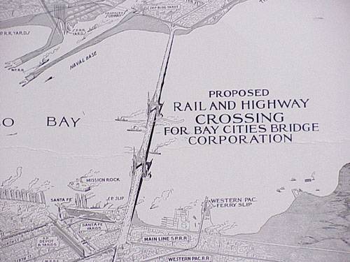
Another early bridge plan, this one anticipating plans in the 1960s and '70s for a "southern crossing."
Image: courtesy Eric Fischer
Proclamation by Emperor Norton I of America, Protector of Mexico
The following is decreed and ordered to be carried into execution as soon as convenient:
1. That a suspension bridge be built from Oakland Point to Goat [now Yerba Buena] Island, and thence to Telegraph Hill; provided such bridge can be built without injury to the navigable waters of the Bay of San Francisco.
2. That the Central Pacific Railroad Company be granted franchises to lay down tracks and run cars from Telegraph Hill and along the city front to Mission Bay.
3. That all deeds of land by the Washington Government since the establishment of our Empire are hereby declared null and void unless our Imperial signature is first obtained thereto.
—Norton I, 1870s
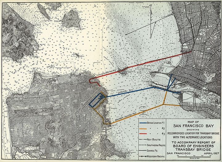
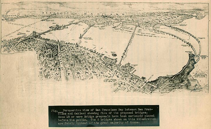
Alternate routes for Bay Bridge as proposed in 1927.
Image: courtesy Eric Fischer
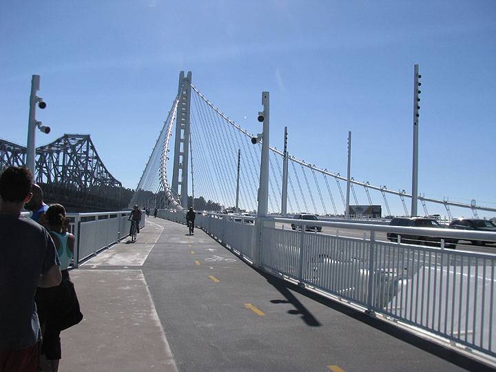
New Bay Bridge bike path and suspension tower, September 2013.
Photo: Chris Carlsson
The September 2013 opening of a new east span of the San Francisco-Oakland Bay Bridge culminates a years-long process to fix the structure after it was damaged during the 1989 Loma Prieta earthquake. Much attention has been paid to the disputes among engineers over the relative safety and stability of the self-suspending design of its signature tower, but little attention has been paid to the context of the Bay Bridge, its half-century role as an impediment to cross-Bay mobility for bicyclists and pedestrians.
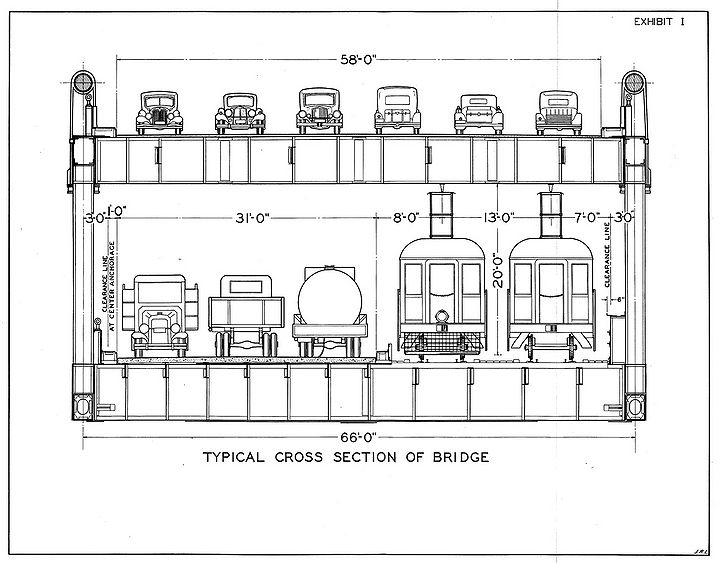
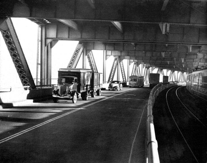
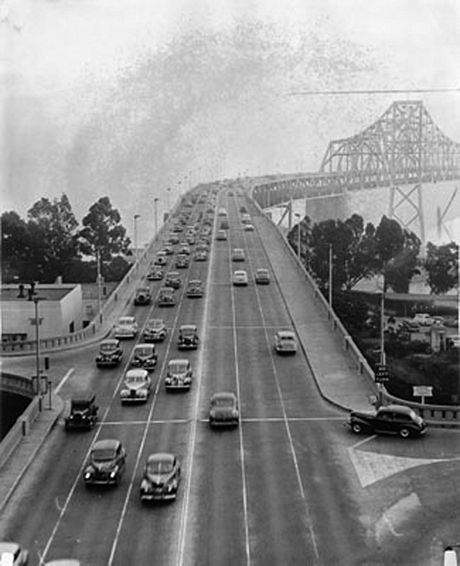
The civic celebrations that accompanied the new east span were considerably less exuberant than the Bridge’s original opening in 1936. At that time thousands of people walked onto the Bridge despite it being declared off-limits to pedestrians, a status it has retained to this day. The overarching emphasis on the Bay Bridge as the central artery for automobile traffic to enter and leave San Francisco has prevailed for over a half century, but it didn't start out that way. From its 1936 opening, the Bridge was designed to accommodate a rising torrent of car traffic, but it took more than twenty years before the Bridge was dedicated to motorized transport only. From 1936 to 1958 it had six lanes on the top deck, three each going east and west for automobiles, while the lower deck had three lanes for trucks and buses, and two tracks for three different train systems to bring passengers into downtown San Francisco.
The original configuration of traffic on the Bay Bridge.
Image: courtesy Eric Fischer
Lower deck in 1940s, trucks, buses, and trains.
Six lanes on top deck of Bay Bridge in this 1946 photo.
Photo: San Francisco History Center, SF Public Library
In the first phase of work in 1960, the San Francisco approaches were reconstructed or newly constructed, the upper deck was strengthened to accommodate truck and bus traffic, and the rail section of the lower deck was paved over. The second phase, which took place in 1961, involved rebuilding the Yerba Buena Island Tunnel and viaducts while strengthening the upper deck. To accomplish this without closing the bridge, the division of highways built a temporary bridge that allowed work to go on while keeping half the tunnel open to traffic. During the final phrase, accomplished in 1962 and 1963, workers strengthened the upper deck on the East Bay crossing, and added new lightweight pavement. The reconstructed decks were opened to unidirectional traffic on October 12, 1963.
The restructure of the Bay Bridge between 1958 and 1963 changed the look as well as the functioning of the structure. Although the bridge retained its essential appearance, the alterations brought the structure into the modern postwar function. No longer was it a quaint multipurpose structure with trains and trucks segregated from automobiles. By 1963 the Bay Bridge was a modernized part of the interstate highway system, carrying I-80 to its western terminus and linking the extensive freeway system on the peninsula with the even more extensive freeway network in the East Bay.
—Stephen D. Mikesell, A Tale of Two Bridges: The San Francisco-Oakland Bay Bridges of 1936 and 2013 (University of Nevada Press: 2017)
1926 proposals for different bridge routes across the Bay.
Image: courtesy Eric Fischer
Prior to the completion of the Bay Bridge, the extensive ferry system carried nearly 50 million commuters per year across the Bay.
Starting in 1939, the Key System brought East Bay commuters across the bridge, and the Sacramento Northern railroad transported people from the northern Central Valley all the way into the heart of the city. But the train systems were losing money, and bridge access didn’t reverse their fortunes. By the end of the 1950s, the prevailing logic of “Motordom” was at full throttle. The associated industries and government bureaucracies dedicated to the expansion of social dependence on private automobiles have always insisted that the solution for traffic congestion was to add capacity.
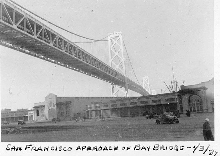
Under the Bay Bridge, January 3, 1937.
Photo: courtesy Ben Valdez
San Francisco’s streets had already been captured by this logic during the late 1920s and early 1930s, as city planners widened roads and imposed new rules on street use, including stop lights, lanes, and crosswalks, all of which was a departure from centuries of unregulated road use by pedestrians and slow-moving vehicles. The impetus to build the Bay Bridge emerged during this period when automobile use was rapidly expanding. Built in just three years during the depths of the Depression, 27 workers died while building it, some falling into the concrete as it was being poured for the anchorage and foundations. Work could not stop to extricate them. Over the three years it took to complete, nearly 8000 men worked on the bridge project.
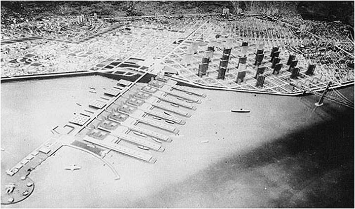
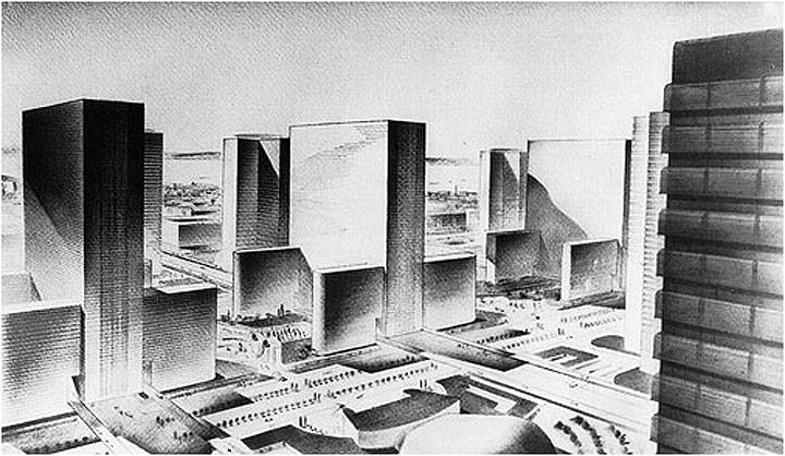
The automobilistic modernism that shaped popular imagination was on full view at the 1939 Treasure Island Golden Gate International Exposition. There, U.S. Steel created a promotional diorama envisioning San Francisco in the year 1999, depicting the South of Market as a series of massive apartment blocks surrounded by elevated roadways.
1939 U.S. Steel diorama at Treasure Island World's Fair, note where Bay Bridge touches down in flattened 1999 South of Market full of highrise towers.
U.S. Steel's version of modernist heaven in San Francisco, projected for 1999.
At the end of WWII, plans were proposed to build a second Bay Bridge alongside the first one. Mayor Elmer Robinson went to Washington D.C. to lobby against it, gaining success by convincing the Pentagon that it would be too vulnerable to attack. But plans to build more bay crossings were still coming fast and furious. Already a long causeway bridge called the San Francisco Bay Toll-Bridge was opened in 1929, later modernized and reopened in 1967 as the San Mateo-Hayward Bridge. The Richmond-San Rafael Bridge was opened in 1956. But the California Department of Highways (now known as Caltrans) was determined to build at least a “Southern Crossing,” an idea that didn't completely die until the early 1970s.
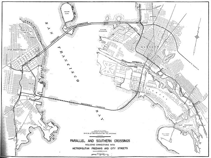
Plans for parallel Bay Bridge and a southern crossing in this 1948 rendering.
Image: courtesy Eric Fischer
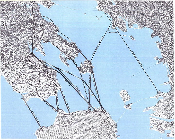
A frenzy of planning led to a crazy proliferation of proposed tunnels and bridges to connect across the Bay, seen here going north and east from San Francisco.
Image: courtesy Eric Fischer
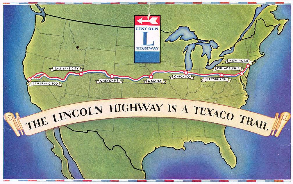
During this same post-WWII era, highway planners got a huge boost when the federal government launched the interstate highway program. The Bay Bridge was already the western end of the so-called “Lincoln Highway,” but now it would be the western keystone of Interstate 80. Meanwhile, in San Francisco planners were busy laying out and then building freeways through the city. The Bay Bridge had originally landed on 5th Street between Bryant and Harrison, but by the mid-1950s the James Lick Freeway curved behind SF General Hospital and through the South of Market to meet up with the Bridge. The Embarcadero Freeway was also connected directly to the Bridge by the late 1950s.
Texaco oil company ad for the Lincoln Highway.
Image: Shaping San Francisco
While all this building was going on, a citizen revolt rose against the highway builders when they saw that thousands of homes in a dozen neighborhoods were slated for demolition to make way for the elevated concrete slabs of the freeway system. It was during this heated controversy over plans to build highways that the Bay Bridge was reconfigured for high speed automobile traffic, five lanes westbound on the top deck and five lanes eastbound on the lower deck. The assumption of the Department of Highways was that most of the new elevated freeways would be built, connecting the south and west sides of San Francisco with the two bridges (Bay and Golden Gate). Much to the shock of the state planners, and even to the whole country, San Francisco refused to build those freeways. It took nearly ten years, but by 1965 the final blow was struck killing plans to build the Panhandle-Golden Gate Park freeway, and also the Golden Gateway freeway that was slated to ring the city’s waterfront, continuing the path of the Embarcadero around to the Golden Gate Bridge.
The Bay Bridge had been reconfigured to maximize auto throughput at 50 mph to connect to the growing network of freeways. Fantasies of smooth flowing high-speed traffic, combined with the incessant advertising of the supposed “freedom of the road,” were nevertheless confronted by the actual conditions: severe traffic jams and daily congestion. The Bridge was usually clogged by rush hour traffic, or severely congested any time of day or night when the inevitable crashes or mechanical breakdowns happened. The “Freeway Revolt” had pushed local planners to embrace BART to replace the commuting capacity they had projected from the expanded freeway systems (and to replace the now destroyed Key surface trolley system), but the same “Revolt” had not led to rethinking how best to use the capacity of the Bay Bridge.
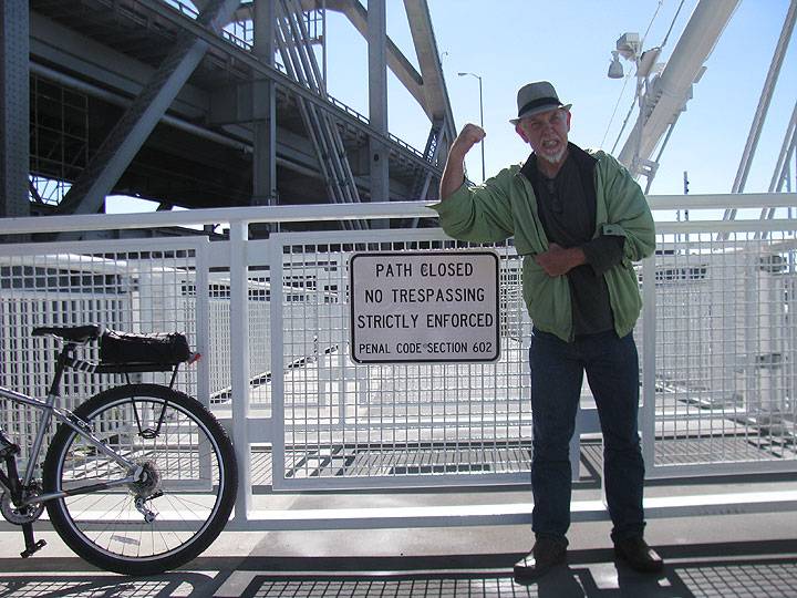
It was not until the 1990s that cycling activists managed to dent the transit professionals’ myopic consensus in favor of automobiles only. Finally Caltrans was pressured into adding a bicycle and pedestrian path to the new east span. But they were not happy about it, and claimed it would cost hundreds of millions more to build. After waiting all this time, the priorities of Caltrans haven’t noticeably changed. They opened the new east span to automobile traffic at the beginning of September, 2013, but the new bike lane is only a bike pier for the next two years. That’s what they claim it will take to finish connecting the bike/ped lane to Yerba Buena Island. Even then, there will be no access to the west span and no way for bicyclists to ride across the Bay Bridge from San Francisco to Oakland or vice versa.
Caltrans claims they are working on a plan to build new decks off the side of the west span, a project expected to take ten years and cost between $500 million and $1 billion! The obvious solution of reorganizing the top deck on the west span, returning it to the original six lanes, reserving one for bicyclists and pedestrians, is somehow unacceptable and is getting no attention from Bridge authorities, transit planners, city politicians or even the bicycle coalitions on both sides of the bay.
Frustrated bicyclist at end of the "Pier" while cars speed by on their way to San Francisco... it's not expected to connect to Yerba Buena Island until 2015.
Photo: Scott Fleming

