Bay Bridge Artery: Difference between revisions
(added Kurt Bank foto) |
No edit summary |
||
| Line 3: | Line 3: | ||
[[Image:Baybridge-with-old-skyline-c1958-photo-by-Kurt-Bank.jpg]] | [[Image:Baybridge-with-old-skyline-c1958-photo-by-Kurt-Bank.jpg]] | ||
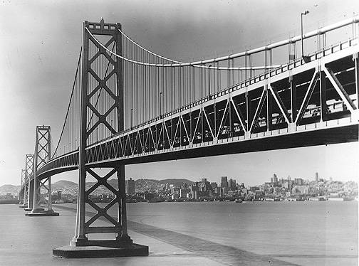
'''1958 photo of Bay Bridge and San Francisco skyline from Yerba Buena Island.''' | '''1958 photo of Bay Bridge and [[Treasure Island Views of SF|San Francisco skyline]] from Yerba Buena Island.''' | ||
''Photo: Kurt Bank'' | ''Photo: Kurt Bank'' | ||
Revision as of 16:48, 14 September 2009
Unfinished History
1958 photo of Bay Bridge and San Francisco skyline from Yerba Buena Island.
Photo: Kurt Bank
File:Soma1$bay-bridge-1995.jpg
The San Francisco-Oakland Bay Bridge 1995 looking towards San Francisco.
The best spot to view the Bay Bridge is from the Embarcadero between Brannan and Howard Streets. The Bay Bridge, built between 1933 and 1936, is an indispensable artery for the economic lifeblood of the Bay Area. Every once in awhile it gets shut down, and Bay Area business screeches to a halt. In 1980, a barrel fell out of a truck crossing the bridge during morning rush hour, releasing a mysterious white powder that quickly spread across the roadway. Traffic stopped completely as the emergency toxic spill squad rushed to the scene, fearing that the white powder could be PCBs, plutonium, or some such deadly substance. It took them until evening to get it all swept up, during which time cars remained stuck, stationary, on the bridge. Many thousands of workers failed to show up in downtown San Francisco that day, with a total cost in lost productivity running well into the millions. When the toxics squad finally got the stuff back to the lab and ran tests on it, they discovered it was white flour. The next day, an embarrassed truck driver admitted that it must have fallen from his truck he hadn't even noticed.
--Dr. Weirde

