Golden Gate Park Lakes: Difference between revisions
(PC) |
(updated next doc link to a renamed page) |
||
| (11 intermediate revisions by 2 users not shown) | |||
| Line 1: | Line 1: | ||
'''<font face = arial light> <font color = maroon> <font size = 3>Unfinished History</font></font> </font>''' | '''<font face = arial light> <font color = maroon> <font size = 3>Unfinished History</font></font> </font>''' | ||
[[Image: | [[Image:1910 Willard Worden inter-dune-pond.jpg]] | ||
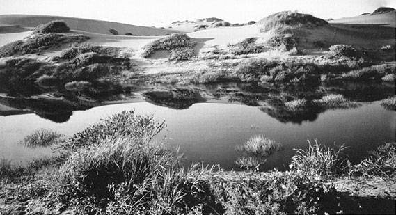
This c. 1910 photo by Willard Worden shows an inter-dune pond in the future Sunset District. Before Golden Gate Park was developed, 14 native inter-dune lakes existed within the park's 1,013 acres. All of the native lakes were filled except the Chain of Lakes, and manmade bodies of water replaced the natural lakes. | |||
''Photo: Private Collection, San Francisco, CA'' | |||
[[Image:Plat-59 Golden-Gate-Park-west-end-1876.jpg|800px]] | |||
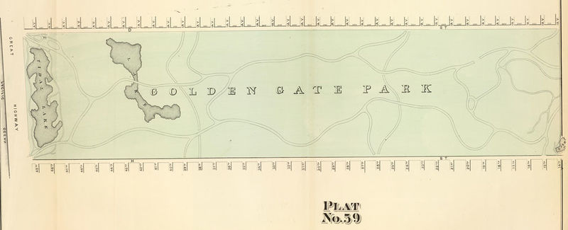
'''1876 map of western end of new Golden Gate Park, showing the original fresh water lakes east of sand ridges, one near the ocean, and the other that later was reconfigured into "Chain of Lakes" near 41st Avenue.''' | |||
''Map: courtesy [https://www.davidrumsey.com/ David Rumsey] collection'' | |||
[[Image:1876 Plat-58 east-end-GG-Park.jpg|800px]] | |||
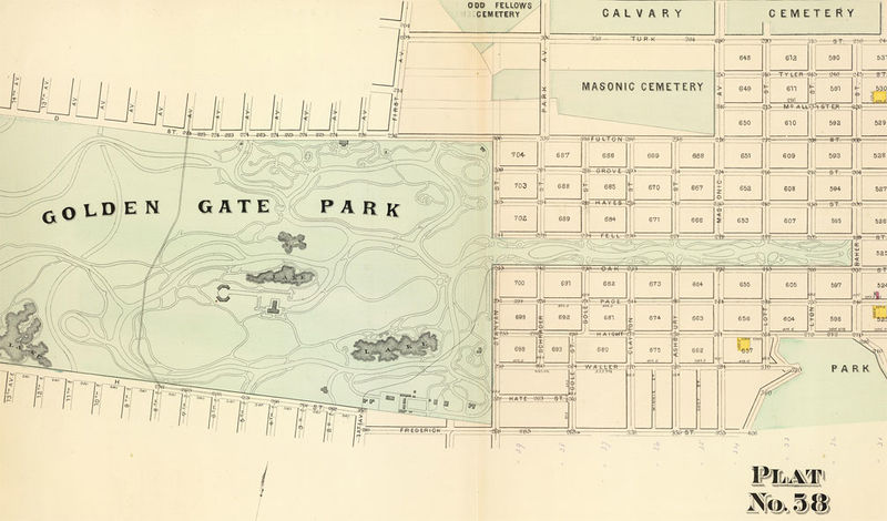
'''Eastern end of Golden Gate Park, 1876, with large-ish lake at site of the Sharon Children's Playground, later filled in. Original [[Old Cemeteries in the City|Big Four cemeteries]] visible at upper right.''' | |||
''Map: courtesy [https://www.davidrumsey.com/ David Rumsey] collection'' | |||
[[Image:Chain-of-lakes 4592.jpg]] | |||
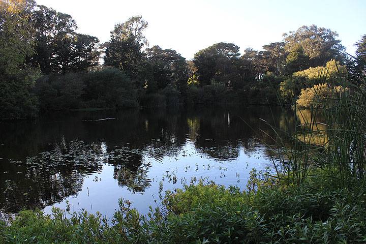
'''Chain of Lakes near western end of Golden Gate Park, 2014.''' | |||
''Photo: Chris Carlsson'' | |||
[[Image:Chain of Lakes circa 1905 wnp15.1719.jpg|800px]] | |||
'''Chain of Lakes with rustic bridge, c. 1897.''' | |||
''Photo: OpenSFHistory.org wnp15.1719'' | |||
[[Image:North Lake, Chain of Lakes, Rustic Bridge, Two women posing on high bridge to island on North Lake. c1900 opensfhistory wnp27.2851.jpg|800px]] | |||
'''North Lake, Chain of Lakes, rustic bridge, two women posting on high bridge to island, c. 1900.''' | |||
''Photo: OpenSFHistory.org wnp27.2851'' | |||
[[Image:Woman posing on concrete rustic bridge, likely on North Lake in Golden Gate Park.opensfhistory wnp37.03245.jpg|800px]] | |||
'''Woman posing on concrete rustic bridge, probably North Lake.''' | |||
''Photo: OpenSFHistory.org wnp37.03245'' | |||
[[Image:Spreckels-Lake 4565.jpg]] | |||
'''Spreckels Lake, home to the S.F. Model Yacht Club, 2014.''' | |||
''Photo: Chris Carlsson'' | |||
[[Image:Elk-glen-lake 4543.jpg]] | |||
'''Elk Glen Lake, 2014.''' | |||
''Photo: Chris Carlsson'' | |||
[[Image:1893-bridge-on-Stow-Lake-to-Strawberry-Hill-island 4515.jpg]] | |||
'''1893 bridge crossing Stow Lake to Strawberry Hill, 2014.''' | |||
''Photo: Chris Carlsson'' | |||
[[Image:Stow-lake-w-birds 4500.jpg]] | |||
'''Stow Lake provides sanctuary to many different birds.''' | |||
''Photo: Chris Carlsson'' | |||
[[Image:Stow-lake 4506.jpg]] | |||
'''Stow Lake, 2014.''' | |||
'' | ''Photo: Chris Carlsson'' | ||
[[Image:ggpk$mallard-lake-2.jpg]] | [[Image:ggpk$mallard-lake-2.jpg]] | ||
| Line 11: | Line 79: | ||
''Photos: Chris Carlsson'' | ''Photos: Chris Carlsson'' | ||
[[Image: | <hr> | ||
<span id="v_sep24-22"><font size=4>September 24, 2022 </font size></span> | |||
<font size=4>Chain o' Lakes, Golden Gate Park</font size> | |||
Our first Walk n Talk Urban Forum of Fall 2022 season, started the north edge of the Northernmost of the Chain of Lakes in western Golden Gate Park. After traversing the width of the park we proceeded west and encounter a number of other stories related to trains, bicycles, feminism, shipwrecks and more! | |||
<iframe src="https://archive.org/embed/chain-o-lakes-walk-n-talk-sept-24-2022" width="640" height="480" frameborder="0" webkitallowfullscreen="true" mozallowfullscreen="true" allowfullscreen></iframe> | |||
[[Image:Chain-o-lakes 20220816 210806668.jpg]] | |||
'''Chain o' Lakes view, 2022.''' | |||
''Photo: Chris Carlsson'' | |||
[[The Day the Biggest Mechanical Toy Stopped | Prev. Document]] [[JFK Drive | Next Document]] | [[The Day the Biggest Mechanical Toy Stopped | Prev. Document]] [[Car-Free JFK Drive | Next Document]] | ||
[[category:Golden Gate Park]] [[category:1990s]] [[category:1910s]] [[category:Ecology]] | [[category:Golden Gate Park]] [[category:1990s]] [[category:1910s]] [[category:Ecology]] [[category:Parks]] [[category:habitat]] [[category:Species]] [[category:2010s]] [[category:1870s]] [[category:1900s]] [[category:Water]] [[category:2020s]] [[category:Water]] | ||
Latest revision as of 14:34, 19 July 2024
Unfinished History
This c. 1910 photo by Willard Worden shows an inter-dune pond in the future Sunset District. Before Golden Gate Park was developed, 14 native inter-dune lakes existed within the park's 1,013 acres. All of the native lakes were filled except the Chain of Lakes, and manmade bodies of water replaced the natural lakes.
Photo: Private Collection, San Francisco, CA
1876 map of western end of new Golden Gate Park, showing the original fresh water lakes east of sand ridges, one near the ocean, and the other that later was reconfigured into "Chain of Lakes" near 41st Avenue.
Map: courtesy David Rumsey collection
Eastern end of Golden Gate Park, 1876, with large-ish lake at site of the Sharon Children's Playground, later filled in. Original Big Four cemeteries visible at upper right.
Map: courtesy David Rumsey collection
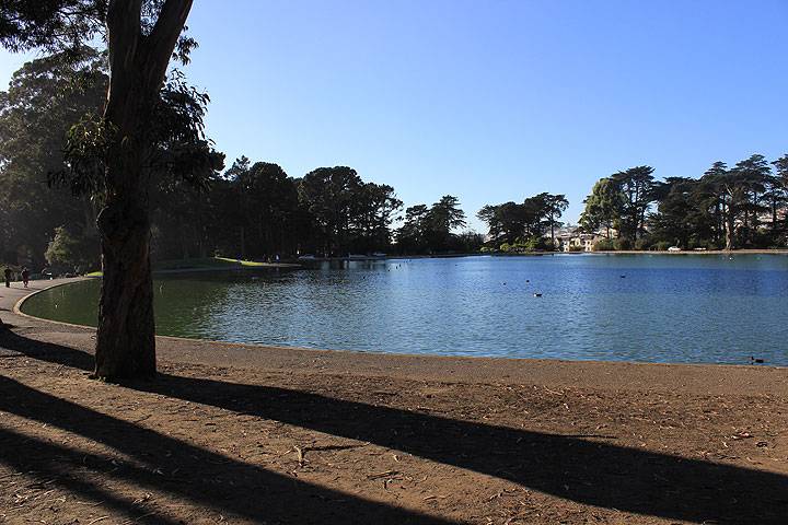
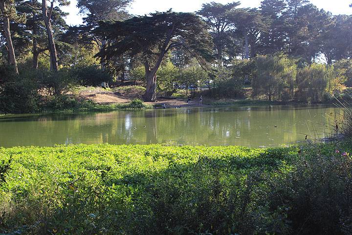
Chain of Lakes near western end of Golden Gate Park, 2014.
Photo: Chris Carlsson
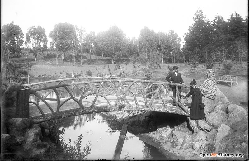
Chain of Lakes with rustic bridge, c. 1897.
Photo: OpenSFHistory.org wnp15.1719
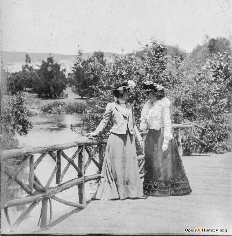
North Lake, Chain of Lakes, rustic bridge, two women posting on high bridge to island, c. 1900.
Photo: OpenSFHistory.org wnp27.2851
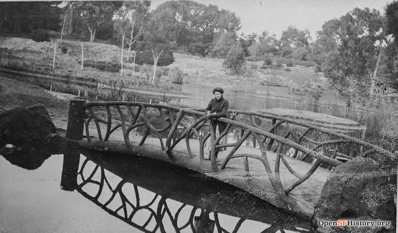
Woman posing on concrete rustic bridge, probably North Lake.
Photo: OpenSFHistory.org wnp37.03245
Spreckels Lake, home to the S.F. Model Yacht Club, 2014.
Photo: Chris Carlsson
Elk Glen Lake, 2014.
Photo: Chris Carlsson
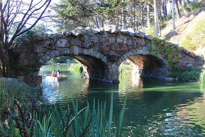
1893 bridge crossing Stow Lake to Strawberry Hill, 2014.
Photo: Chris Carlsson
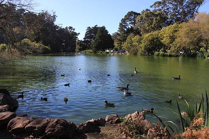
Stow Lake provides sanctuary to many different birds.
Photo: Chris Carlsson
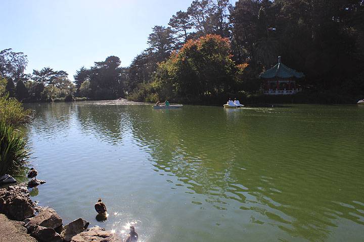
Stow Lake, 2014.
Photo: Chris Carlsson
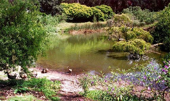
Mallard Lake, with its namesake inhabitants.
Photos: Chris Carlsson
September 24, 2022
Chain o' Lakes, Golden Gate Park
Our first Walk n Talk Urban Forum of Fall 2022 season, started the north edge of the Northernmost of the Chain of Lakes in western Golden Gate Park. After traversing the width of the park we proceeded west and encounter a number of other stories related to trains, bicycles, feminism, shipwrecks and more!
<iframe src="https://archive.org/embed/chain-o-lakes-walk-n-talk-sept-24-2022" width="640" height="480" frameborder="0" webkitallowfullscreen="true" mozallowfullscreen="true" allowfullscreen></iframe>
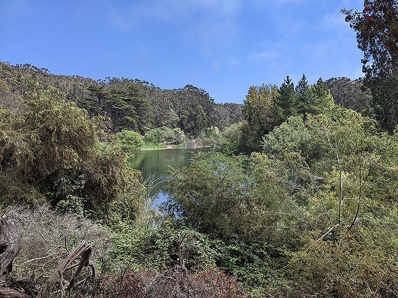
Chain o' Lakes view, 2022.
Photo: Chris Carlsson

