Islais Creek Covered: Difference between revisions
m removed from water tour, added page content type |
updated link to renamed page |
||
| (13 intermediate revisions by 3 users not shown) | |||
| Line 5: | Line 5: | ||
'''As seen from the Mission Viaduct, the proposed Alemany Boulevard along the course of Islais Creek, running down from Glen Canyon to the marshes between Bernal Heights and Bayview/Hunters' Point, 1910.''' | '''As seen from the Mission Viaduct, the proposed Alemany Boulevard along the course of Islais Creek, running down from Glen Canyon to the marshes between Bernal Heights and Bayview/Hunters' Point, 1910.''' | ||
''Photo: | ''Photo: Private Collection, San Francisco, CA'' | ||
[[Image:Alemany islais-creek-1911.jpg]] | [[Image:Alemany islais-creek-1911.jpg]] | ||
| Line 11: | Line 11: | ||
'''1911''' | '''1911''' | ||
''Photo: | ''Photo: Private Collection, San Francisco, CA'' | ||
[[Image: | [[Image:101 and 280 Jun 24, 1930--wnp36.03941.jpg|793px]] | ||
''' | '''Approximately at intersection of today's freeways, Highway 101 and I-280, June 24, 1930.''' | ||
''Photo: | ''Photo: courtesy OpenSFHistory.org wnp36.03941'' | ||
[[Image:Alemany storm drain, looking east to Mt. St. Joseph in background West of Folsom Aug 1930--wnp36.03949.jpg|793px]] | |||
'''August 1930. Looking east to Mt. St. Joseph.''' | |||
''Photo: courtesy OpenSFHistory.org wnp36.03949'' | |||
[[Image:May 14 1930 Alemany storm drain, Section A Culverting Islais Creek dpwbookBROWNBOOK dpwA2550 wnp36.04490.jpg]] | |||
'''May 14, 1930: Alemany storm drain, culverting Islais Creek.''' | |||
''Photo: OpenSFHistory.org wnp36.04490 DPW A2550'' | |||
[[Image:May 14 1930 View west toward Mission Viaduct, St. Marys Park homes on Justin Drive at right Alemany storm drain, Section A Culverting Islais Creek dpwbookBROWNBOOK dpwA2549wnp36.04489.jpg]] | |||
'''May 14, 1930: View west toward Mission Viaduct, [[St Mary's Development|St. Mary's Park homes]] on Justin Drive at right.''' | |||
''Photo: OpenSFHistory.org wnp36.04489 DPW A2549'' | |||
[[Image:Alemany islais-creek-1930.jpg]] | [[Image:Alemany islais-creek-1930.jpg]] | ||
| Line 23: | Line 41: | ||
'''1930. Note the building at upper right, which reappears in the following photos.''' | '''1930. Note the building at upper right, which reappears in the following photos.''' | ||
''Photo: | ''Photo: Private Collection, San Francisco, CA'' | ||
[[Image:Alemany islais-creek-1960s.jpg]] | [[Image:Alemany islais-creek-1960s.jpg]] | ||
| Line 29: | Line 47: | ||
'''1960, Islais Creek now completely buried beneath Alemany Boulevard.''' | '''1960, Islais Creek now completely buried beneath Alemany Boulevard.''' | ||
''Photo: | ''Photo: Private Collection, San Francisco, CA'' | ||
[[Image:Alemany I-280 islais-creek-1980s.jpg]] | [[Image:Alemany I-280 islais-creek-1980s.jpg]] | ||
'''1980s, Interstate-280 has taken over the waterway, pushing Alemany Blvd. to its south.''' | '''1980s, [[Before the I-280 Freeway|Interstate-280]] has taken over the waterway, pushing Alemany Blvd. to its south.''' | ||
''Photo: Private Collection, San Francisco, CA'' | |||
<hr> | |||
[[Image: | [[Image:Tours-transit.gif|link=BART: Bechtel's Baby]] [[BART: Bechtel's Baby| Continue Transit History Tour]] | ||
[[Over the Waters . . . | Prev. Document]] [[ | [[Over the Waters . . . | Prev. Document]] [[Alemany 1926 | Next Document]] | ||
[[category:Excelsior | [[category:Excelsior]] [[category:Ecology]] [[category:Water]][[category:Roads]] [[category:1910s]] [[category:Glen Park]] [[category:1930s]] [[category:1960s]] [[category:1980s]] | ||
Latest revision as of 17:17, 11 May 2023
Historical Photo Essay
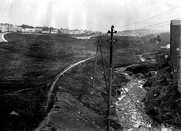
As seen from the Mission Viaduct, the proposed Alemany Boulevard along the course of Islais Creek, running down from Glen Canyon to the marshes between Bernal Heights and Bayview/Hunters' Point, 1910.
Photo: Private Collection, San Francisco, CA
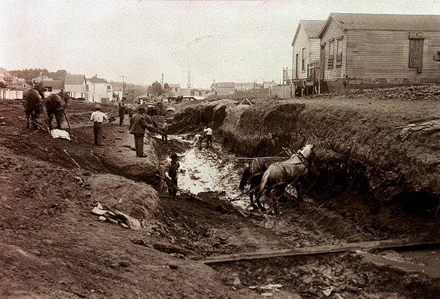
1911
Photo: Private Collection, San Francisco, CA
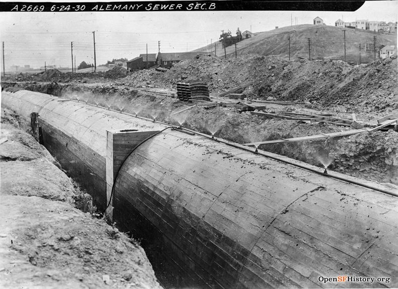
Approximately at intersection of today's freeways, Highway 101 and I-280, June 24, 1930.
Photo: courtesy OpenSFHistory.org wnp36.03941
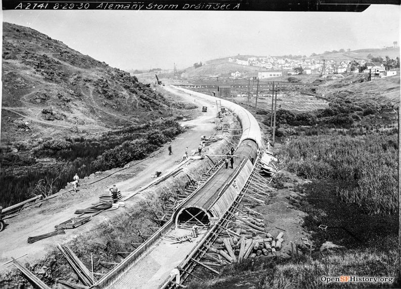
August 1930. Looking east to Mt. St. Joseph.
Photo: courtesy OpenSFHistory.org wnp36.03949
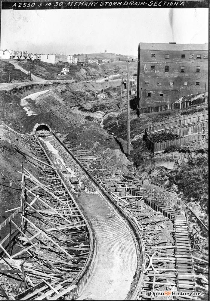
May 14, 1930: Alemany storm drain, culverting Islais Creek.
Photo: OpenSFHistory.org wnp36.04490 DPW A2550
May 14, 1930: View west toward Mission Viaduct, St. Mary's Park homes on Justin Drive at right.
Photo: OpenSFHistory.org wnp36.04489 DPW A2549
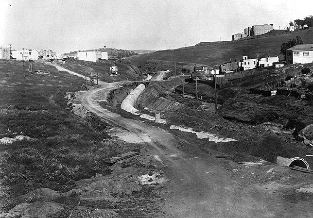
1930. Note the building at upper right, which reappears in the following photos.
Photo: Private Collection, San Francisco, CA
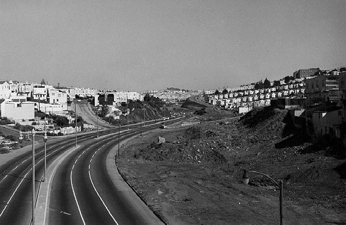
1960, Islais Creek now completely buried beneath Alemany Boulevard.
Photo: Private Collection, San Francisco, CA
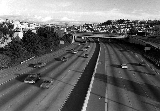
1980s, Interstate-280 has taken over the waterway, pushing Alemany Blvd. to its south.
Photo: Private Collection, San Francisco, CA

