Haight Street 1940s: Difference between revisions
m (Added current photo of Haight and Clayton.) |
No edit summary |
||
| Line 6: | Line 6: | ||
''Photo: San Francisco History Center, San Francisco Public Library'' | ''Photo: San Francisco History Center, San Francisco Public Library'' | ||
[http://maps.google.com/maps?f=q&source=s_q&hl=en&geocode=&q=haight+street,+san+francisco,+ca&sll=40.487899,-74.446701&sspn=0.112017,0.220757&ie=UTF8&hq=&hnear=Haight+St,+San+Francisco,+California&ll=37.769884,-122.447906&spn=0,359.978027&z=16&layer=c&cbll=37.769876,-122.448018&panoid=OckpAj8XEQQ8-7306BxUqw&cbp=12,276.05,,0,-1.91 The same location as of 2009] | |||
[[Image:Haight_and_Clayton_2023.jpg|720px]] | [[Image:Haight_and_Clayton_2023.jpg|720px]] | ||
| Line 12: | Line 14: | ||
''Photo: Eihway Su'' | ''Photo: Eihway Su'' | ||
[[Image:H&COL946.jpg]] | [[Image:H&COL946.jpg]] | ||
Revision as of 18:29, 20 January 2023
Unfinished History
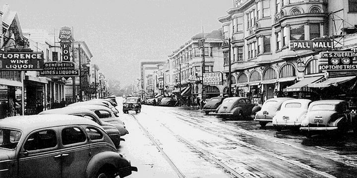
Haight Street between Ashbury and Clayton, looking west, 1944
Photo: San Francisco History Center, San Francisco Public Library
Haight Street between Ashbury and Clayton, looking west, 2023
Photo: Eihway Su
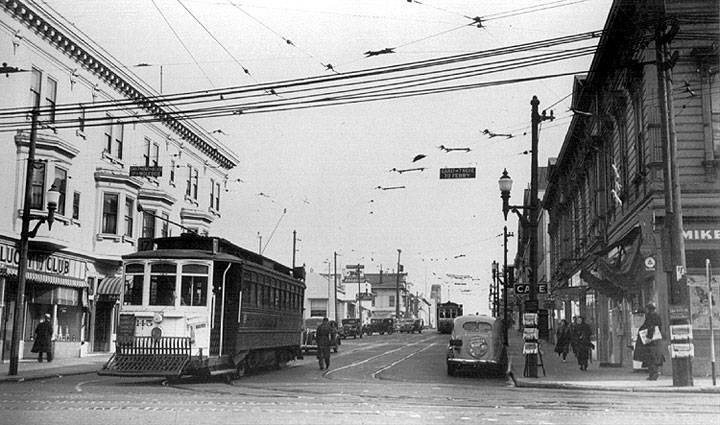
Haight and Cole, 1946.
Photo: Private collector
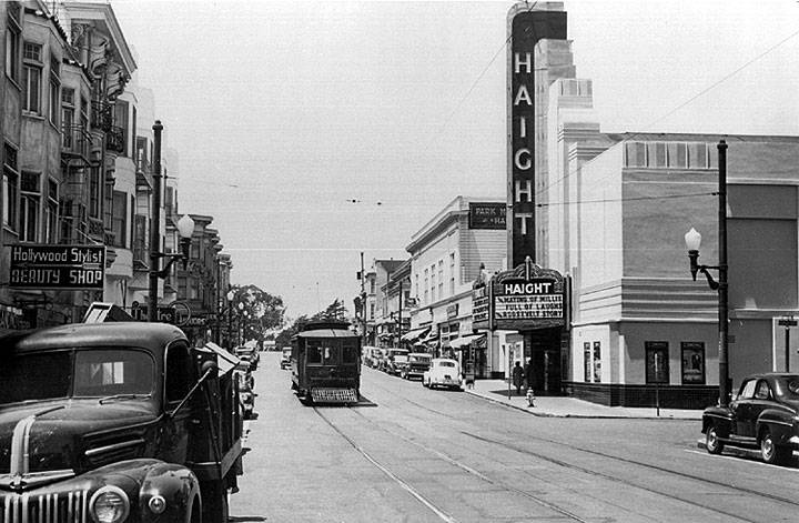
From Haight Theater To Goodwill, The History Of 1700 Haight Street
Haight and Stanyan, c. 1940.
Photo: Private collector
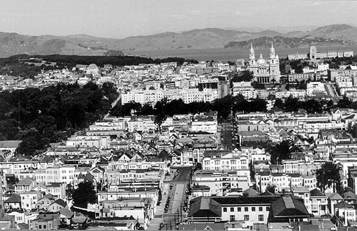
Northerly view over Cole Valley and the Haight, the Panhandle and St. Ignatius, c. 1949.
Photo: Private collector


