Potrero Avenue 1930s: Difference between revisions
added new photo and category |
added links |
||
| (6 intermediate revisions by 2 users not shown) | |||
| Line 5: | Line 5: | ||
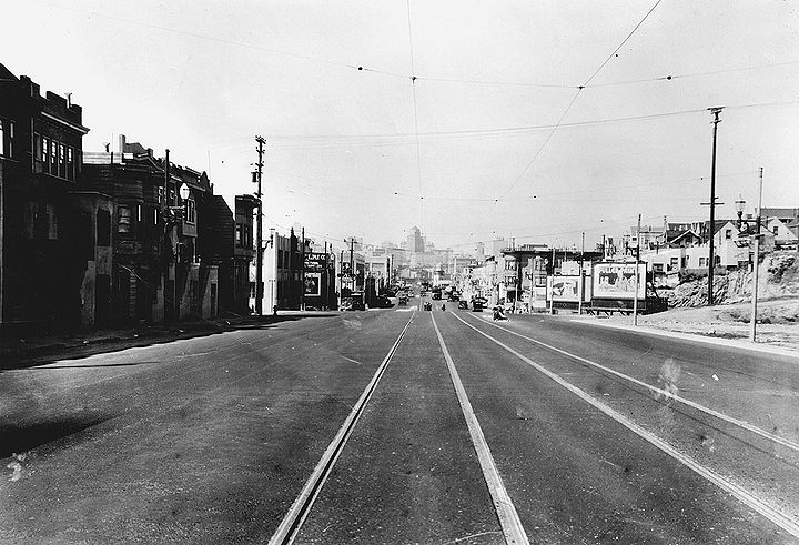
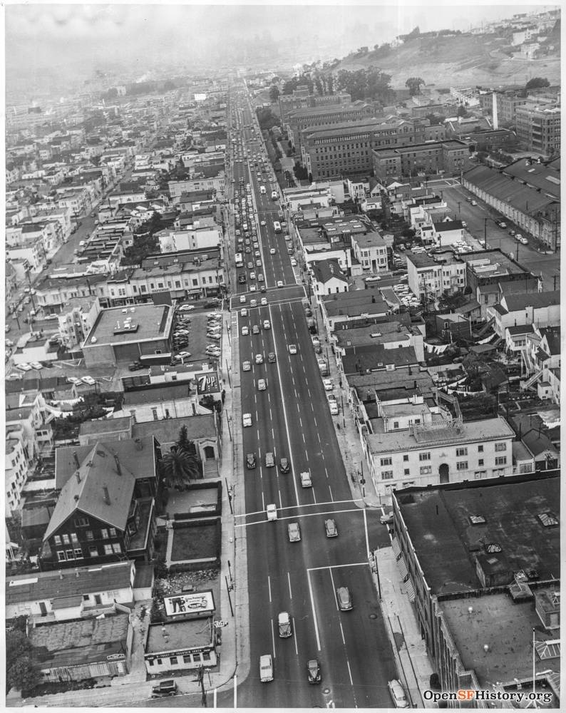
'''Potrero Avenue north from 19th Street (formerly US Highway 101, and H-line streetcar) on April 12, 1935.''' | '''Potrero Avenue north from 19th Street (formerly US Highway 101, and H-line streetcar) on April 12, 1935.''' | ||
''Photo: SFDPW, courtesy | ''Photo: SFDPW, courtesy C. R. collection'' | ||
[[Image:mission$potrero-and-18th-1938.jpg]] | [[Image:mission$potrero-and-18th-1938.jpg]] | ||
| Line 11: | Line 11: | ||
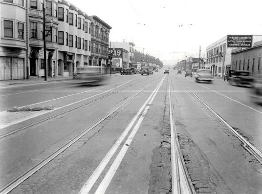
'''Potrero Avenue looking south between 18th and Mariposa Streets, c. 1938''' | '''Potrero Avenue looking south between 18th and Mariposa Streets, c. 1938''' | ||
''Photo: Private Collection | ''Photo: Private Collection'' | ||
[[Image:Potrero at 22nd 1940 AAB-5135.jpg]] | [[Image:Potrero at 22nd 1940 AAB-5135.jpg]] | ||
| Line 17: | Line 17: | ||
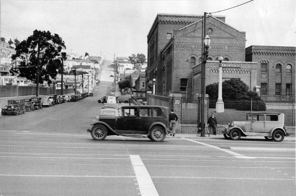
'''Potrero Avenue looking east towards Potrero Hill on 22nd Street, with General Hospital to right, 1940.''' | '''Potrero Avenue looking east towards Potrero Hill on 22nd Street, with General Hospital to right, 1940.''' | ||
''Photo: San Francisco History Center, | ''Photo: San Francisco History Center, San Francisco Public Library'' | ||
[[ | [[Image:View south toward the southwest corner of 24th and Potrero, Nicholls Hardware, 2641 24th Street 1951 wnp58.846.jpg|800px]] | ||
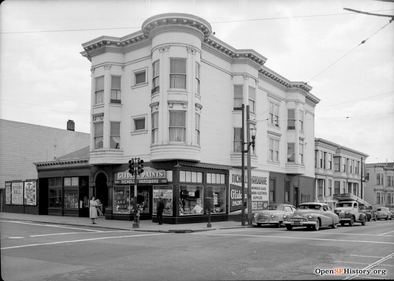
[[category:Mission]] [[category:1930s]] [[category:Potrero Hill]] | '''Southeasterly view of corner of 24th and Potrero, Nicholls Hardware at 2641 24th Street, 1951.''' | ||
''Photo: OpenSFHistory.org wnp58.846'' | |||
[[Image:1951 Potrero Avenue looking north w Settlement House Safeway and SFGH opensfhistory wnp27.5959.jpg]] | |||
'''1951 view north on Potrero Avenue, [[Good Samaritan Center|Good Samaritan Settlement House]] at lower left, Safeway at corner of 24th and Potrero, and [[San Francisco General Hospital|SF General Hospital]] in distance.''' | |||
''Photo: OpenSFHistory.org wnp27.5959'' | |||
[[Image:Potrero-Avenue-south-at-21st c1996 0024.jpg]] | |||
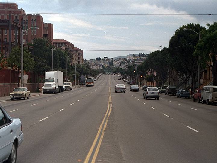
'''Potrero Avenue south from 21st Street, 1996.''' | |||
''Photo: Chris Carlsson'' | |||
[[Image:Potrero-Avenue-south-from-21st 20180920 140729.jpg]] | |||
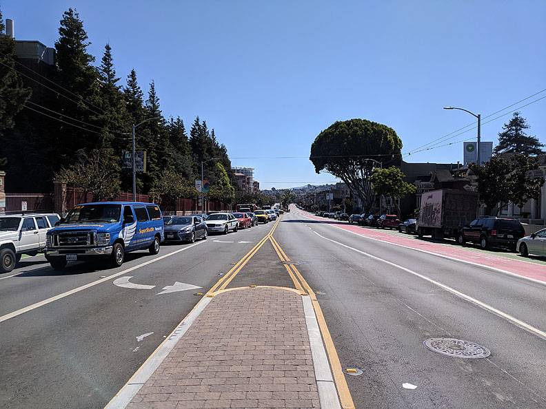
'''Potrero Avenue south from 21st Street, 2018.''' | |||
''Photo: Chris Carlsson'' | |||
[[Openers at Mission High |Prev. Document]] [[An Eyewitness Recounts the Quake of 1906 |Next Document]] | |||
[[category:Mission]] [[category:1930s]] [[category:Potrero Hill]] [[category:1990s]] [[category:roads]] [[category:2010s]] [[category:1950s]] | |||
Latest revision as of 20:13, 1 August 2022
Unfinished History
Potrero Avenue north from 19th Street (formerly US Highway 101, and H-line streetcar) on April 12, 1935.
Photo: SFDPW, courtesy C. R. collection
Potrero Avenue looking south between 18th and Mariposa Streets, c. 1938
Photo: Private Collection
Potrero Avenue looking east towards Potrero Hill on 22nd Street, with General Hospital to right, 1940.
Photo: San Francisco History Center, San Francisco Public Library
Southeasterly view of corner of 24th and Potrero, Nicholls Hardware at 2641 24th Street, 1951.
Photo: OpenSFHistory.org wnp58.846
1951 view north on Potrero Avenue, Good Samaritan Settlement House at lower left, Safeway at corner of 24th and Potrero, and SF General Hospital in distance.
Photo: OpenSFHistory.org wnp27.5959
Potrero Avenue south from 21st Street, 1996.
Photo: Chris Carlsson
Potrero Avenue south from 21st Street, 2018.
Photo: Chris Carlsson

