Ghost Streets of San Francisco: Difference between revisions
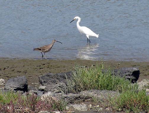
corrected bird shown in photo with egret |
added Ed Ferris caption and two new photos to bottom of page |
||
| (One intermediate revision by one other user not shown) | |||
| Line 161: | Line 161: | ||
So that’s my far from complete tour of some of San Francisco’s Ghost Streets… feel free to chime in with your own favorites and maybe we can develop an whole alternative map of the city for Phantoms, Apparitions and Utopians Only! | So that’s my far from complete tour of some of San Francisco’s Ghost Streets… feel free to chime in with your own favorites and maybe we can develop an whole alternative map of the city for Phantoms, Apparitions and Utopians Only! | ||
[[category:Roads]] [[category:2000s]] [[category:Bayview/Hunter's Point]] [[category:Bernal Heights]] [[category:Noe Valley]] [[category:Castro]] [[category:Potrero Hill]] | <hr> | ||
In the 1960s, Ed Ferris and his friends would play on the several flights of stairs at 22nd street at Diamond st in Noe Valley, often riding down the stairs on pieces of plywood. | |||
[[Image:22nd & Diamond Aug 10 1926 wnp36.03456.jpg|800px]] | |||
'''22nd Street stairs looking up from Diamond Street, Aug. 10, 1926, not long after they were built.''' | |||
''Photo: OpenSFHistory.org'' | |||
[[Image:22nd-Street-stairs-westerly-Sept-24-2015 P1050280.jpg]] | |||
'''Same stairway, looking west from the top in 2015.''' | |||
''Photo: Chris Carlsson'' | |||
[[category:Roads]] [[category:2000s]] [[category:Bayview/Hunter's Point]] [[category:Bernal Heights]] [[category:Noe Valley]] [[category:Castro]] [[category:Potrero Hill]] [[category:1920s]] [[category:2010s]] | |||
Latest revision as of 23:41, 13 September 2021
Historical Essay
by Chris Carlsson
Originally published at sf.streetsblog.org, August 24, 2009
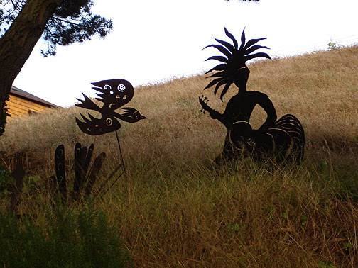
Ghosts cavort where Castro Street should be!
Photo: Chris Carlsson
Intrepid explorers of San Francisco regularly stumble upon the many ghost streets that still hide all over town, rewarding the patient pedestrian for their diligence. Mostly they are on hillsides where steep grades impeded road building at earlier moments in history, but they’re still presented as if they were through-streets on the maps.
A tour begins with an old map and lots of photos below the break.
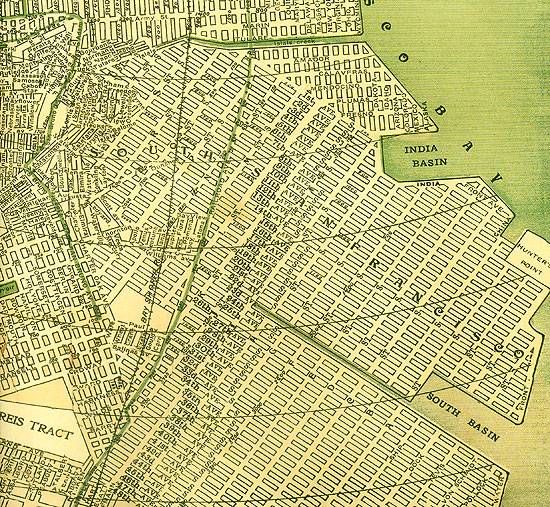
1909 map of southeastern San Francisco. Most of the streets here are still under water, awaiting a bayfill effort.
Other ghost streets can be found not on foot but by exploring old maps, where one can enjoy the strange city that extends well into the bay off the southeastern shoreline. I’ve heard rumors, or maybe I saw a story in the Chronicle decades ago, about families that continue to pay their property tax annually on parcels that are well into the bay and thoroughly under water. On this 1909 map of the Yosemite Creek area, streets going NW/SE are numbered and alphabetized but they later got real names. The perpendicular grid of alphabetized streets were eventually given real names (similar to what happened in the "outside lands" of the Richmond and Sunset). But on this 1909 map, Jennings, Ingalls, Hawes, Griffith, and Fitch (J, I, H, G, F) are followed southeast into the bay by E, D, C, B, and A streets, and five further blocks with the names, Ship, Dock, Tevis, Von Schmidt, and Pollock before arriving at "Water Front" boulevard. Obviously these streets were never created since the bayfill on which they depended never happened.
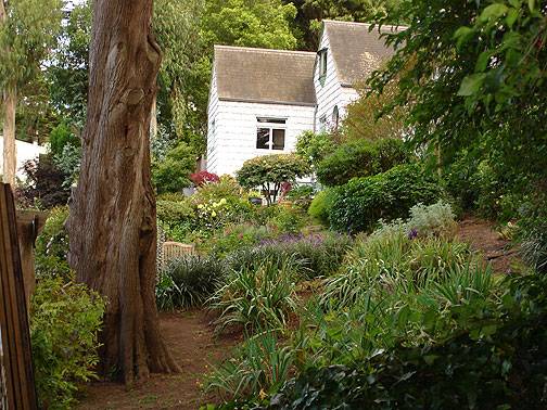
Spectacular garden adjacent to Harry "Street."
Photo: Chris Carlsson
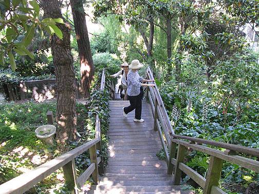
Harry "Street" in its forest.
Photo: Chris Carlsson
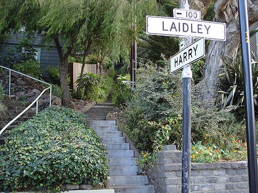
Where Harry Meets Laidley.
Photo: Chris Carlsson
My favorite ghost streets are short blocks, usually either bedecked with amazing gardens tended by loving neighbors, or else just odd stubs that continue to defy the rigid grid-imposing city planners of days gone by. In these small patches of nature, sometimes groomed, sometimes not, we can free our imaginations from the sterile symmetry imposed by endless blocks of asphalt crisscrossing the city. When we whisper to each other "One Lane for Food" or other equally "preposterous" depaving notions, the ghost streets echo back to us a knowing wink with a survivor’s resilience. Probably the best patch of ghost streets in town is the Filbert Steps and its cross "streets" Napier Lane and Darrell Place. The Grace Marchant Garden that fills most of the Filbert right of way on the east side of Telegraph Hill is one of the true ecological treasures of San Francisco, home too to a big flock of much-celebrated parrots.
Filbert Steps on Telegraph Hill, Grace Marchant Garden to right in photo.
Photo: Chris Carlsson
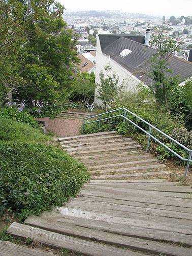
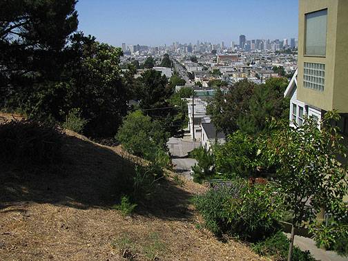
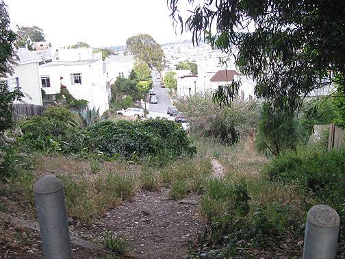
I live near 24th and Folsom which gives me a good staging area for visiting the ghost streets of Potrero Hill, Bernal Heights, and both Noe and Eureka Valleys. There are many more than I can fully list or display here, and yes, you can take that as an invitation to get out there and explore! But a couple of my favorites on Potrero Hill are Kansas between 22nd and 20th, and 19th Street between Rhode Island and DeHaro. Potrero Hill in particular used to be a favorite walk many years ago when you could walk up the hillside below McKinley Square and visit the amazing community garden at Vermont and 20th, or take this Kansas ghost path uphill, continue to 19th, and then go right (east) to the ghost of 19th, popping out above the high school and then skirting the Potrero Commons that once graced the slopes above the old Northwest Pacific railroad tunnel (the train’s right of way makes another ghost of transit past, cutting diagonally northwest from Potrero Hill through the Showplace Square area before petering out in the confluence of Potrero, Division, 10th, and Brannan Streets…).
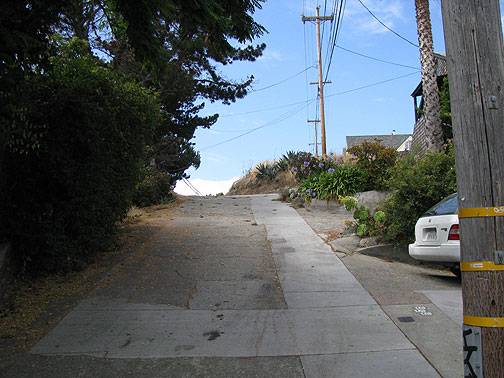
Kansas "Street" just north of 22nd Street.
Photo: Chris Carlsson
View south from top of Kansas "Street".
Photo: Chris Carlsson
19th "Street" at Rhode Island.
Photo: Chris Carlsson
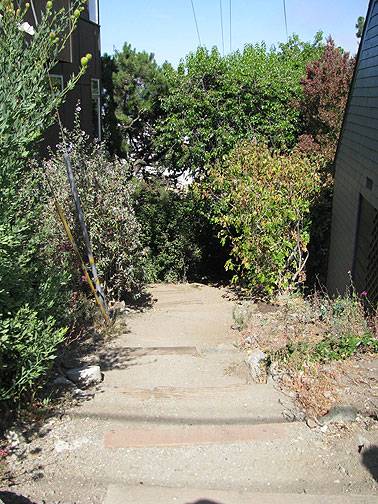
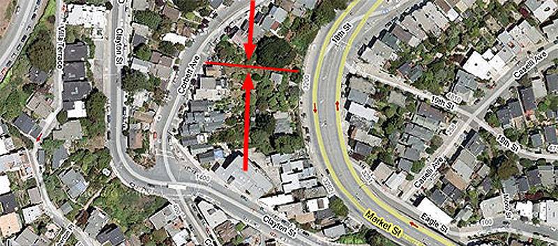
A real undiscovered treasure close to the intersection of Corbett and Clayton that I wrote about not long ago in the context of historic water wars and the charming garden that’s been planted on the corner, is Al’s Park. This curious ribbon of whimsy and nature rises from the mural on upper Market Street (next to the pink historic Joost House) and emerges on Corbett. My 1995 Thomas Bros. map has it labeled as 19th Street (multiple ghostly incarnations for 19th!) but Google’s Satellite map doesn’t show there as being any public right of way there. Enter Al’s Park from Corbett and enjoy a strange, almost 19th century-feeling slice of eccentric San Francisco land use.
Al’s Park along the thin red line between Market and Corbett. It is on some maps labeled "19th Street."
Photo: Chris Carlsson
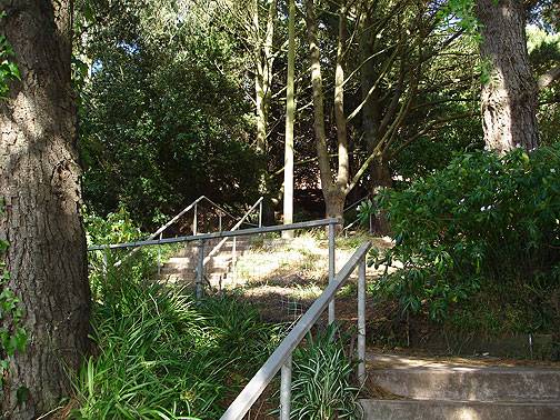
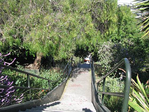
Not too far from Al’s Park on the northern slopes of Eureka Valley is the ghost of Saturn street that plunges from a cul-de-sac where the street seems to end into a slope with view benches, two staircases, and a lovely landscaping that accompanies one down to Ord Street. Just a few hundred feet to the north are the Vulcan Steps, another of San Francisco’s many amazing public stairways serving private homes with cool, inviting porches and elegant, tree- and flower-filled gardens.
Saturn "Street" with views across Eureka Valley.
Photo: Chris Carlsson
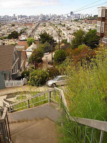
Back on Bernal Heights, where hundreds of new stairs have been installed in the past few years, especially around the rim and the eastern slope, there’s a long legacy of ghost streets. Peralta and Franconia both start and stop from north to the summit and in the case of Peralta all the way down to the Alemany Farmers’ Market, punctuated by incredible views, stairways, and gardens all the way. An east-west street near the southern edge of the hilltop is Powhattan and it has its own ghost block between Gates and Ellsworth. Further to the southeast Tompkins Street also has a ghost block between Nevada and Putnam. And probably the best known ghost street on Bernal is Esmeralda, which has a brief life as a thoroughfare on the east side of the summit, but is one of the hill’s most glorious stairways down the west side.
Esmeralda above Elsie Street.
Photo: Chris Carlsson
I only found this ghost of Harrison Street beneath Ripley a few weeks ago, missing it for years on many walks up Bernal.
Photo: Chris Carlsson
Tompkins and Nevada on southeastern slopes of Bernal Heights.
Photo: Chris Carlsson
Peralta "Street" looking north.
Photo: Chris Carlsson
Powhattan at Ellsworth looking east.
Photo: Chris Carlsson
I joined the India Basin Neighborhood Association for a guided tour of their shoreline on August 8, and enjoyed the fantasies and plans of the neighbors juxtaposed to the designs of the Redevelopment Agency for that long-lost corner of the city. India Basin is a favorite haunt of mine, home to Heron’s Head Park, India Basic Open Space, and the historic Albion Brewery. It’s been the main access to the Hunter’s Point Naval Base, but these days, with the rebuilding starting and the naval shipyards long gone, the area is just beginning its gentrification process.
A Whimbrel and an Egret share some chow time along India Basin shore.
Photo: Chris Carlsson
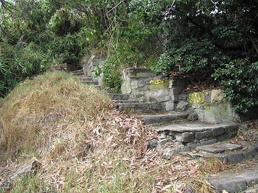
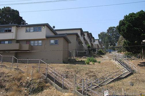
A big roadblock to full-scale upscaling are the dozens of 1940s barracks-style public housing projects at Westbrook and Hunters View. I was struck by the ghost streets here too, staircases filling the zone that could have been Fitch Street or Griffith Street. But out here the landscape is parched, the neighbors indifferent, and the possibilities of flourishing, permaculturally designed corridors along the stairs remote at best. Even as native species habitat it was pretty bereft.
Westbook Public Housing at Fitch Street above Innes Avenue.
Photo: Chris Carlsson
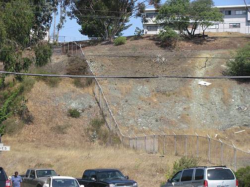
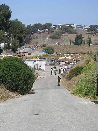
Interestingly, the Neighborhood Association presented many ambitious development plans for the area, including a "restaurant row" along Jennings, more offices and shops near the open shoreline at the south side of the basin, and another idea that some of us found a bit disturbing: Hudson Street is a ghostly presence out there, like a derelict alley running east-west just north of Innes Avenue, the main boulevard. But where it should cross Innes and continue westward up the hill into the Hunters View Projects, there is only a fence to mark the city’s "right of way." The slope here is a hotspot of native habitat, so aficionados of plants and insects of our original eco-niche are especially interested in saving this hillside from becoming a through street. The Neighbors, for their part, saw a through Hudson Street as a way of relieving the heavy traffic on Hunters Point Blvd and Innes Avenue.
"Hudson Street" (the fence) above Hawes and Innes.
Photo: Chris Carlsson
From a quarter mile further west, looking back along Hudson Street towards same hillside as photo above.
Photo: Chris Carlsson
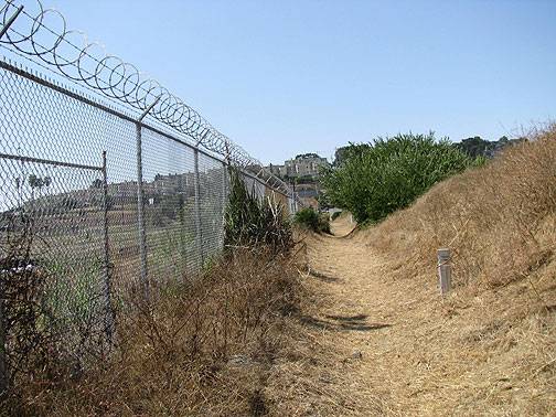
Another ghost street, mostly a specter of fantasizing urban planners, is Earl Street, which runs along the fence separating the India Basin Open Space and some private properties from the former Naval Base. As you can see it’s just a footpath along the fence for a good part of its life, and where it is a street, it’s more like a private driveway.
"Earl Street" at edge of Hunters’ Point Naval Shipyard.
Photo: Chris Carlsson
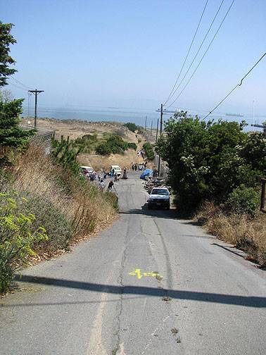
Looking north along Earl from Innes.
Photo: Chris Carlsson
So that’s my far from complete tour of some of San Francisco’s Ghost Streets… feel free to chime in with your own favorites and maybe we can develop an whole alternative map of the city for Phantoms, Apparitions and Utopians Only!
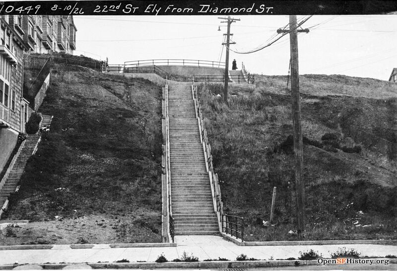
In the 1960s, Ed Ferris and his friends would play on the several flights of stairs at 22nd street at Diamond st in Noe Valley, often riding down the stairs on pieces of plywood.
22nd Street stairs looking up from Diamond Street, Aug. 10, 1926, not long after they were built.
Photo: OpenSFHistory.org
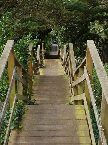
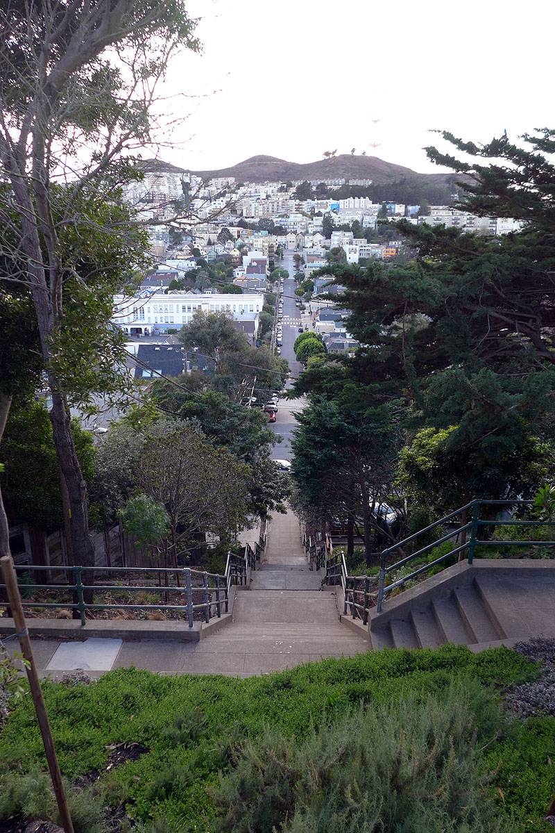
Same stairway, looking west from the top in 2015.
Photo: Chris Carlsson

