Candlestick Point State Recreation Area: Difference between revisions
new page with images and sounds from Oct. 08 Talk |
No edit summary |
||
| (8 intermediate revisions by 2 users not shown) | |||
| Line 1: | Line 1: | ||
'''<font face = arial light> <font color = maroon> <font size = 3>Unfinished History</font></font> </font>''' | '''<font face = arial light> <font color = maroon> <font size = 3>Unfinished History</font></font> </font>''' | ||
<iframe src="https://archive.org/embed/hidden-san-francisco-stop-e-17-yosemite-slough-and-candlestick-point-sra" width="640" height="480" frameborder="0" webkitallowfullscreen="true" mozallowfullscreen="true" allowfullscreen></iframe> | |||
<hr> | |||
[[Image:Foundsf-hsf-icon.gif|link=Unraveling the Mystery of Lake Dolores]]<br> | |||
Next Stop #15: [[Unraveling the Mystery of Lake Dolores|The Myth of Lake Dolores]] | |||
<hr> | |||
[[Image:West-view-from-cpsra-towards-stadium-and-Bayview-hill-0940.jpg]] | [[Image:West-view-from-cpsra-towards-stadium-and-Bayview-hill-0940.jpg]] | ||
| Line 7: | Line 16: | ||
''Photo: Chris Carlsson'' | ''Photo: Chris Carlsson'' | ||
< | <iframe src="https://archive.org/embed/ClaudeEverhartOnCandlestickPointStateRecreationArea" width="500" height="40" frameborder="0" webkitallowfullscreen="true" mozallowfullscreen="true" allowfullscreen></iframe> | ||
</ | |||
'''Claude Everhart, a founder of Friends of Candlestick, describes the public process that led to the Candlestick Point State Recreation Area as a natural park on the bayshore, built on landfill, created by community input and control.''' | '''Claude Everhart, a founder of Friends of Candlestick, describes the public process that led to the Candlestick Point State Recreation Area as a natural park on the bayshore, built on landfill, created by community input and control.''' | ||
| Line 27: | Line 34: | ||
[[Image:Couple-walks-trail-at-cpsra-08.jpg]] | [[Image:Couple-walks-trail-at-cpsra-08.jpg]] | ||
''Couple walks trail at Candlestick Point State Recreation Area.''' | '''Couple walks trail at Candlestick Point State Recreation Area.''' | ||
''Photo: Alan Hopkins, Golden Gate Audubon Society'' | ''Photo: Alan Hopkins, Golden Gate Audubon Society'' | ||
| Line 33: | Line 40: | ||
[[Image:Yosemite-creek-from-bayview-hill-20.jpg]] | [[Image:Yosemite-creek-from-bayview-hill-20.jpg]] | ||
'''Yosemite Creek, with the two protruding rocks known as "Double Rock" in mouth, as seen from Bayview Hill on a sunny winter day. Hunter's Point is swathed in uncharacteristic green.''' | '''[[Lost Beach Near Yosemite Creek|Yosemite Creek]], with the two protruding rocks known as "Double Rock" in mouth, as seen from Bayview Hill on a sunny winter day. Hunter's Point is swathed in uncharacteristic green.''' | ||
''Photo: Alan Hopkins, Golden | ''Photo: Alan Hopkins, Golden Gate Audubon Society'' | ||
[[Image:Double-rock-with-hp-behind-23.jpg]] | [[Image:Double-rock-with-hp-behind-23.jpg]] | ||
| Line 56: | Line 63: | ||
< | <iframe src="https://archive.org/embed/CandlestickPointStateParkForThePeople" width="500" height="40" frameborder="0" webkitallowfullscreen="true" mozallowfullscreen="true" allowfullscreen></iframe> | ||
</ | |||
'''This is the full 2-hours of the Shaping San Francisco Talk at CounterPULSE, held on Oct. 29, 2008. | '''This is the full 2-hours of the Shaping San Francisco Talk at CounterPULSE, held on Oct. 29, 2008. | ||
[[Yosemite Creek|Prev. Document]] [[ | [[Lost Beach Near Yosemite Creek|Prev. Document]] [[Shipwright's Cottage|Next Document]] | ||
[[category:Bayview/Hunter's Point]] [[category:1990s]] [[category:shoreline]] [[category:water]] [[category:2000s]] [[category:African-American]] | [[category:Bayview/Hunter's Point]] [[category:1990s]] [[category:shoreline]] [[category:water]] [[category:2000s]] [[category:African-American]] [[category:species]] [[category:habitat]] | ||
Latest revision as of 14:06, 31 August 2020
Unfinished History
![]()
Next Stop #15: The Myth of Lake Dolores
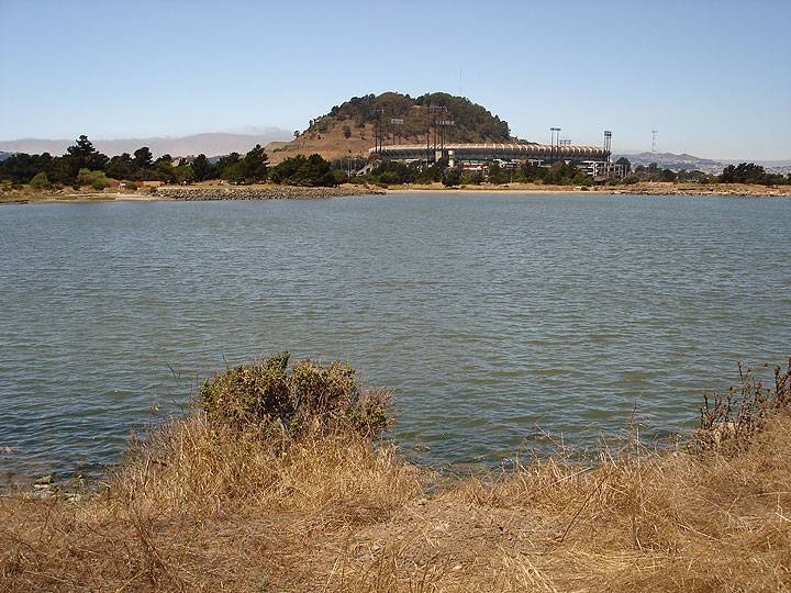
View westerly from Candlestick Point State Recreation Area towards Bayview Hill with Candlestick Park beneath.
Photo: Chris Carlsson
Claude Everhart, a founder of Friends of Candlestick, describes the public process that led to the Candlestick Point State Recreation Area as a natural park on the bayshore, built on landfill, created by community input and control.
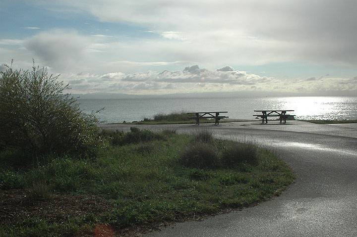
Clouds and bay from Candlestick Point State Recreation Area, looking southeasterly.
Photo: Alan Hopkins, Golden Gate Audubon Society
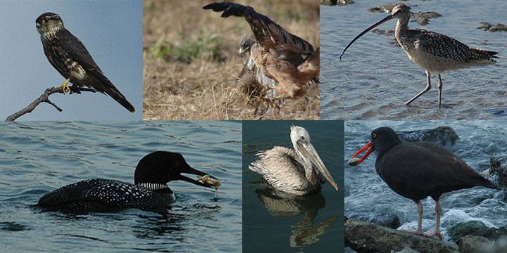
Different bird species photographed at Candlestick State Recreation Area. From left to right, top: Pigeon Hawk, Red-tailed Hawk, Long-billed Curlew; bottom: Common Loon, White Pelican, Black Oystercatcher
Photos: Alan Hopkins, Golden Gate Audubon Society
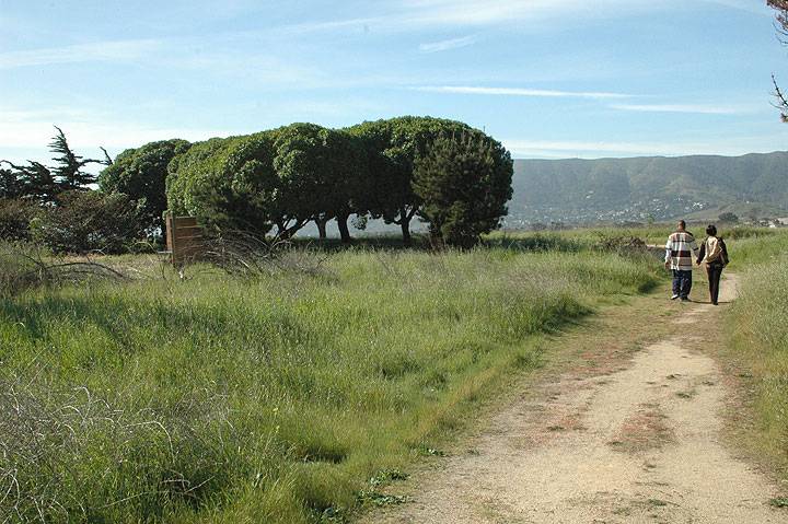
Couple walks trail at Candlestick Point State Recreation Area.
Photo: Alan Hopkins, Golden Gate Audubon Society
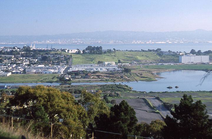
Yosemite Creek, with the two protruding rocks known as "Double Rock" in mouth, as seen from Bayview Hill on a sunny winter day. Hunter's Point is swathed in uncharacteristic green.
Photo: Alan Hopkins, Golden Gate Audubon Society
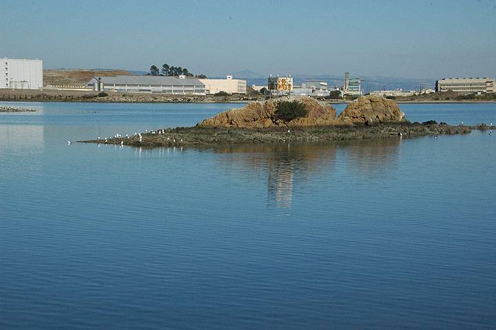
Double Rock at low tide, Hunter's Point to north, in background.
Photo: Alan Hopkins, Golden Gate Audubon Society
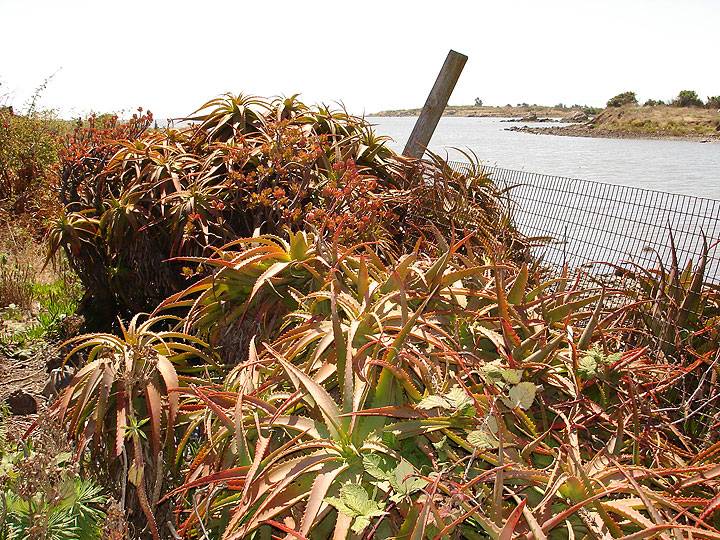
Flourishing cactus garden on north bank of Yosemite Creek, not far from where a Green Tortoise guerrilla campsite once sat.
Photo: Chris Carlsson
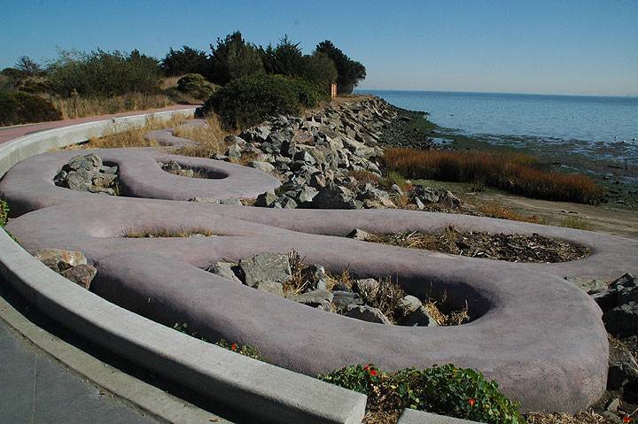
This snake sculpture is one of several public art installations in Candlestick SRA, this one on the southern edge of the park.
Photo: Alan Hopkins, Golden Gate Audubon Society
This is the full 2-hours of the Shaping San Francisco Talk at CounterPULSE, held on Oct. 29, 2008.

