The First Grab: Difference between revisions
(Changed credits from Greg Garr to Private Collection) |
(rescanned map) |
||
| Line 21: | Line 21: | ||
Subsequently Leese moved to Sonoma, and transferred his cattle away from San Bruno Mountain. In 1849, he traded the Mountain to Robert T. Ridley for the latter's Rancho Collayomi in Lake County. Ridley died in 1851 and his title to San Bruno Mountain was sold at a sheriff's auction. | Subsequently Leese moved to Sonoma, and transferred his cattle away from San Bruno Mountain. In 1849, he traded the Mountain to Robert T. Ridley for the latter's Rancho Collayomi in Lake County. Ridley died in 1851 and his title to San Bruno Mountain was sold at a sheriff's auction. | ||
[[Image: | [[Image:San-Bruno-Mountain-map-c-1840.jpg]] | ||
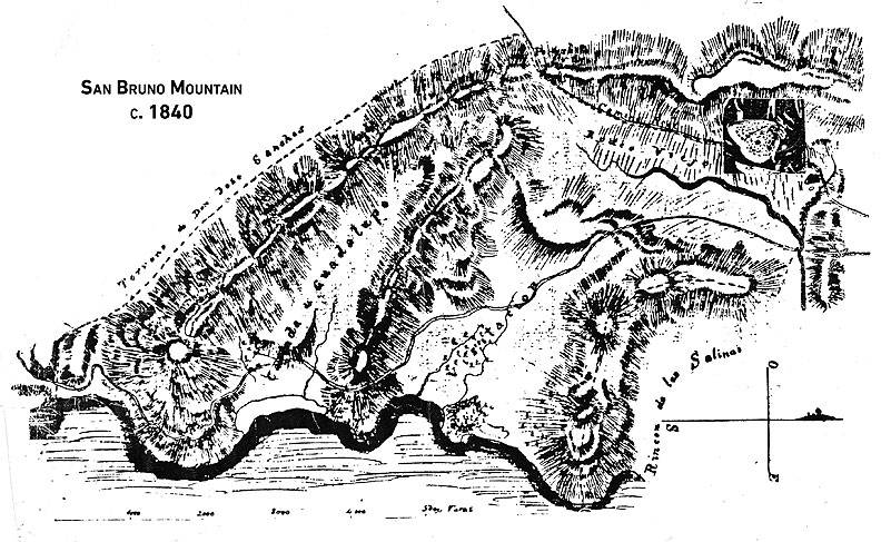
'''Map of [[San Bruno Mountain|San Bruno Mountain]] requested by Leese in the 1840's was made by Jean Jacques Vioget, a Swiss surveyor who then lived at Yerba Buena.''' ''Map: [[SAN BRUNO MOUNTAIN WATCH|San Bruno Mountain Watch]]'' | '''Map of [[San Bruno Mountain|San Bruno Mountain]] requested by Leese in the 1840's was made by Jean Jacques Vioget, a Swiss surveyor who then lived at Yerba Buena.''' ''Map: [[SAN BRUNO MOUNTAIN WATCH|San Bruno Mountain Watch]]'' | ||
Revision as of 21:57, 5 February 2020
Historical Essay
by Chris Carlsson
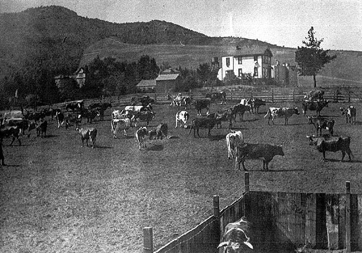
Cows grazing in Cole Valley, c. 1901.
Photo: Private Collection, San Francisco, CA
COWS?! In SAN FRANCISCO?!?
Cattle grazing on locals hills and valleys was common: Jacob Leese had his running on San Bruno Mountain in 1839. Small ranches tamed the dunes that later became SF's western neighborhoods. Today's Marina District still carries the old moniker "Cow Hollow" dating from its 19th century life as the site to several dozen small dairy farms.
In the winter of 1839, settler Jacob Primer Leese brought his cattle to San Bruno Mountain. He fenced a field for the cultivation of grain in Guadalupe Valley (now Crocker Industrial Park), and erected a house for his four Indian vaqueros. In Visitacion Valley he erected another house for his foreman (near today's Cow Palace).
In 1841, Leese received approval from General Juan Bautista Alvarado for a grant of two square leagues---more than thirteen square miles along the shore and rising ground of the San Francisco Bay. Leese described a San Bruno Mountain land grant before the new US land commissioners as follows:
On the southern side of the boundary line of Jose Sanchez (Rancho Buri Buri, South San Francisco) is the foot of the mountain, beginning at a pile of rocks situated about four or five hundred yards from the bay and extending to the Portezuela (the gap in the hills at the west end of San Bruno Mtn.), and from said Portezuela following the road (Mission Street) down towards San Francisco till you come to a brook (Islais Creek) and a mound of rocks of a gray color, then running down (eastwardly) to the lower road, which is called the byroad to Visitacion, following up that road from the rising ground and on top of this rising ground (McLaren Park), which separates the Visitacion Valley from the valley known by the name of Rincon Salinas, to the bay.
Subsequently Leese moved to Sonoma, and transferred his cattle away from San Bruno Mountain. In 1849, he traded the Mountain to Robert T. Ridley for the latter's Rancho Collayomi in Lake County. Ridley died in 1851 and his title to San Bruno Mountain was sold at a sheriff's auction.
Map of San Bruno Mountain requested by Leese in the 1840's was made by Jean Jacques Vioget, a Swiss surveyor who then lived at Yerba Buena. Map: San Bruno Mountain Watch


