Highway 101: Difference between revisions
(changed credit on''''Bayshore freeway north at Army Street offramp, 1956. The 101 freeway is still unfinished in distance.'''photo which came from CR collection) |
(changed photo credit on second to last photo to reflect it's part of SFPL collection) |
||
| Line 53: | Line 53: | ||
[[Image:24VMT993.jpg]] | [[Image:24VMT993.jpg]] | ||
''Photos: | ''Photos: San Francisco History Center, San Francisco Public Library (AAB-5992) (1930) and David Green (1994)'' | ||
[[Freeways trashed by 89 quake |Prev. Document]] [[Hidden Class Politics of Transit |Next Document]] | [[Freeways trashed by 89 quake |Prev. Document]] [[Hidden Class Politics of Transit |Next Document]] | ||
[[category:Transit]] [[category:1950s]] [[category:1930s]] [[category:Potrero Hill]] [[category:1990s]] [[category:Mission]] [[category:2010s]] [[category:Bernal Heights]] | [[category:Transit]] [[category:1950s]] [[category:1930s]] [[category:Potrero Hill]] [[category:1990s]] [[category:Mission]] [[category:2010s]] [[category:Bernal Heights]] | ||
Revision as of 14:30, 27 April 2017
Unfinished History
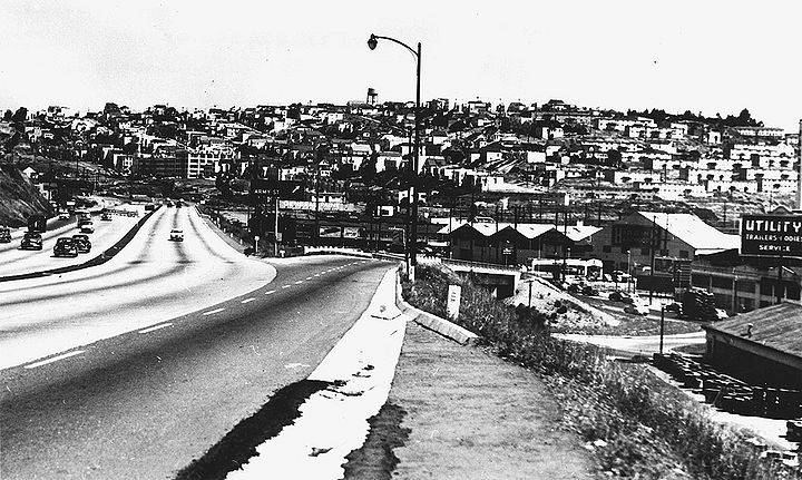
The James Lick Freeway (Highway 101) in 1957, northbound, just past Vermont St. exit off Potrero Hill.
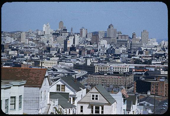
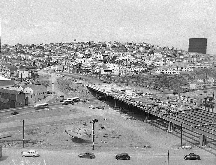
View northward from 20th and Rhode Island on Potrero Hill, Hwy 101 in center of image, April 10, 1955.
Charles Cushman Collection: Indiana University Archives (P07970)
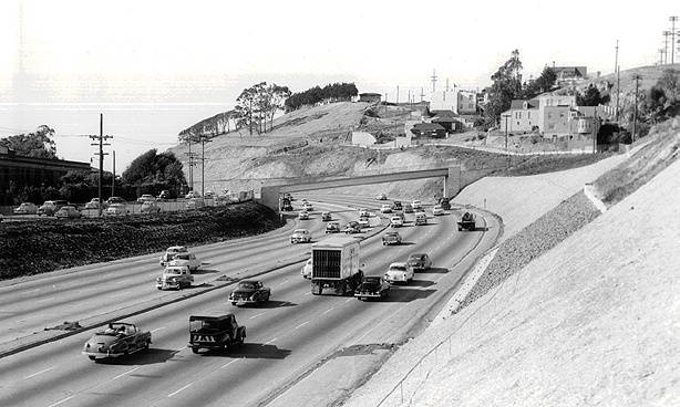
The James Lick Freeway (Highway 101) in 1957, northbound from 23rd Street overpass.
Photos: San Francisco History Center, San Francisco Public Library
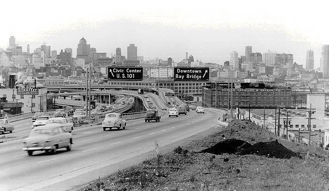
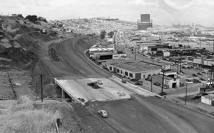
Bayshore freeway north at Army Street offramp, 1956. The 101 freeway is still unfinished in distance.
Photo: C.R. collection
Highway 101 at Army under construction, 1955, with Potrero Hill in background.
Photo: Private Collector
Building Highway 101 where it crosses Cortland Avenue alongside Bernal Heights, 1955.
Photo: Private Collector
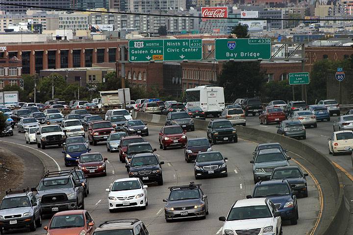
Highway 101 full of autos in 2014.
Photo: Chris Carlsson
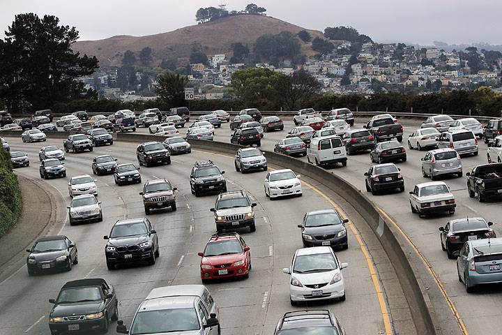
Hospital Curve southbound, Highway 101, with Bernal Heights.
Photo: Chris Carlsson
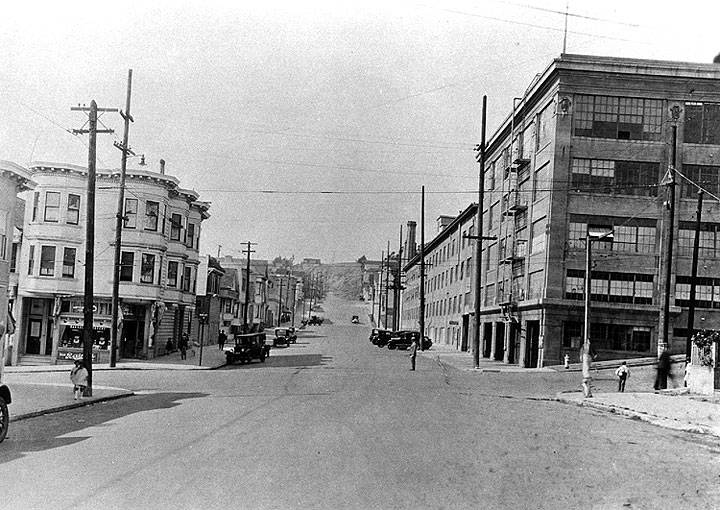
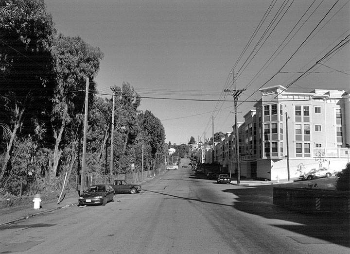
In 1930 the Dutch Boy Paint Factory sat the corner of 24th and Kansas (above). By 1994 the west side of Kansas Street had been demolished and replaced by the 101 Freeway, hidden by eucalyptus trees in this 1994 image, and a new apartment building had replaced the paint factory (below).
Photos: San Francisco History Center, San Francisco Public Library (AAB-5992) (1930) and David Green (1994)

