Bernal's Name: Difference between revisions
No edit summary |
(moved content here from dumb "Bernal Heights Social Uses" page which is being deleted!) |
||
| Line 3: | Line 3: | ||
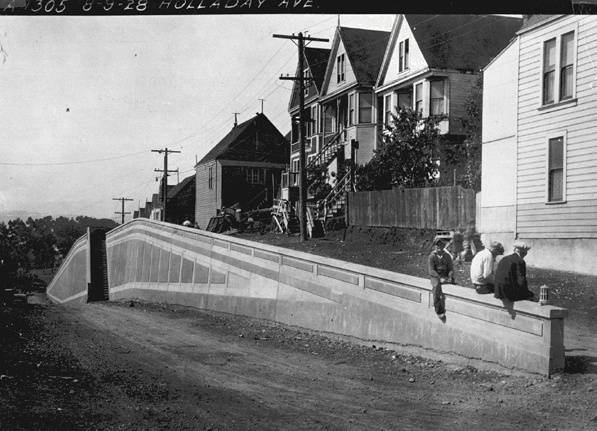
[[Image:bernlhts$holladay-ave.jpg]] | [[Image:bernlhts$holladay-ave.jpg]] | ||
'''Holladay Avenue, northeast corner of Bernal Heights, August 9, 1928''' ''photo: | '''Holladay Avenue, northeast corner of Bernal Heights, August 9, 1928''' | ||
''photo: Private Collection'' | |||
A [[Rancho Era|Mexican land grant]], ''Potrero Viejo'' (covering Islais Creek Basin and Hunters Point) was owned by José Cornelio Bernal''', '''whose name ultimately came to grace the large hill directly south of today's Mission District. | A [[Rancho Era|Mexican land grant]], ''Potrero Viejo'' (covering Islais Creek Basin and Hunters Point) was owned by José Cornelio Bernal''', '''whose name ultimately came to grace the large hill directly south of today's Mission District. | ||
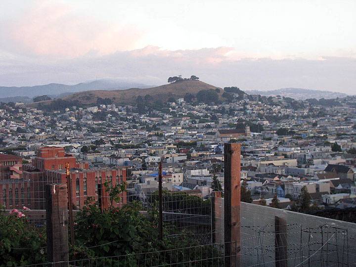
[[Image:Bernal-hts-from-potrero 9691.jpg]] | |||
'''A view of Bernal Heights from Potrero Hill, with San Bruno Mountain and its radio towers in the distance at left. In the foreground is the Mission District, [[St. Peter's Church|St. Peter's Church]] is the large building just above the post.''' | |||
''photo: Chris Carlsson'' | |||
The [[Bernal Heights Boulevard|ring road around Bernal Heights]] was once home to [[Soapbox Society | Soapbox Derby]] racing every 3rd Sunday, and was once the training mountain for [[Managua North: San Francisco's Solidarity Movement | Sandinista militants]] who later went to Nicaragua and helped start the 1979 revolution. | |||
[[SLA safe house | Prev. Document]] [[Powhattan 1997 | Next Document]] | [[SLA safe house | Prev. Document]] [[Powhattan 1997 | Next Document]] | ||
Revision as of 15:13, 29 September 2014
Unfinished History
Holladay Avenue, northeast corner of Bernal Heights, August 9, 1928
photo: Private Collection
A Mexican land grant, Potrero Viejo (covering Islais Creek Basin and Hunters Point) was owned by José Cornelio Bernal, whose name ultimately came to grace the large hill directly south of today's Mission District.
A view of Bernal Heights from Potrero Hill, with San Bruno Mountain and its radio towers in the distance at left. In the foreground is the Mission District, St. Peter's Church is the large building just above the post.
photo: Chris Carlsson
The ring road around Bernal Heights was once home to Soapbox Derby racing every 3rd Sunday, and was once the training mountain for Sandinista militants who later went to Nicaragua and helped start the 1979 revolution.


