Brotherhood Way: Difference between revisions
(added link to WPA article) |
(added photos) |
||
| Line 43: | Line 43: | ||
''Photo: San Francisco History Center, San Francisco Public Library'' | ''Photo: San Francisco History Center, San Francisco Public Library'' | ||
[[Image:Brotherhood-Way 2834.jpg]] | |||
[[category:SFSU]] [[category:OMI/Ingleside]] [[category:1930s]] [[category:1920s]] [[category:1860s]] [[category:roads]] [[category:1950s]] [[category:1960s]] | '''Brotherhood Way looking west from Chumasero Drive, 2014.''' | ||
''Photo: Chris Carlsson'' | |||
[[Image:Brotherhod-Way-from-Junipero-Serra 2835.jpg]] | |||
'''Brotherhood Way at intersection with Charles Avenue, Junipero Serra crossing on overpass in distance (looking westward), 2014.''' | |||
''Photo: Chris Carlsson'' | |||
[[Image:Bufano-Peace 2851.jpg|420px]] | |||
'''One of many [[Beniamino Bufano on Public Art|Beniamino Bufano]] sculptures around San Francisco, this one on his favorite topic: Peace, installed along Brotherhood Way.''' | |||
''Photo: Chris Carlsson'' | |||
[[Image:Hawk-on-Brotherhood-Way 2840.jpg]] | |||
'''Amidst what was once sand dunes and a creek gulley, today are many Monterey Pines and other introduced tree species, which in turn have attracted wildlife that didn't have much habitat in this area once upon a time.''' | |||
''Photo: Chris Carlsson'' | |||
[[category:SFSU]] [[category:OMI/Ingleside]] [[category:1930s]] [[category:1920s]] [[category:1860s]] [[category:roads]] [[category:1950s]] [[category:1960s]] [[category:2010s]] [[category:ecology]] | |||
Revision as of 14:46, 5 August 2014
Unfinished History
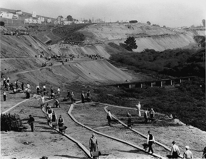
Brotherhood Way (then Stanley Drive) being built by the Works Project Administration (WPA) in 1934, connecting Junipero Serra Blvd. with Lake Merced Drive, looking east towards Junipero Serra (white railing in distance at right).
Photo: Charles Ruiz collection
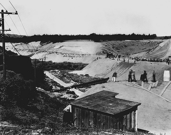
Brotherhood Way (then Stanley Drive) viewed from Junipero Serra looking westward towards Lake Merced, 1934.
Photo: Charles Ruiz collection
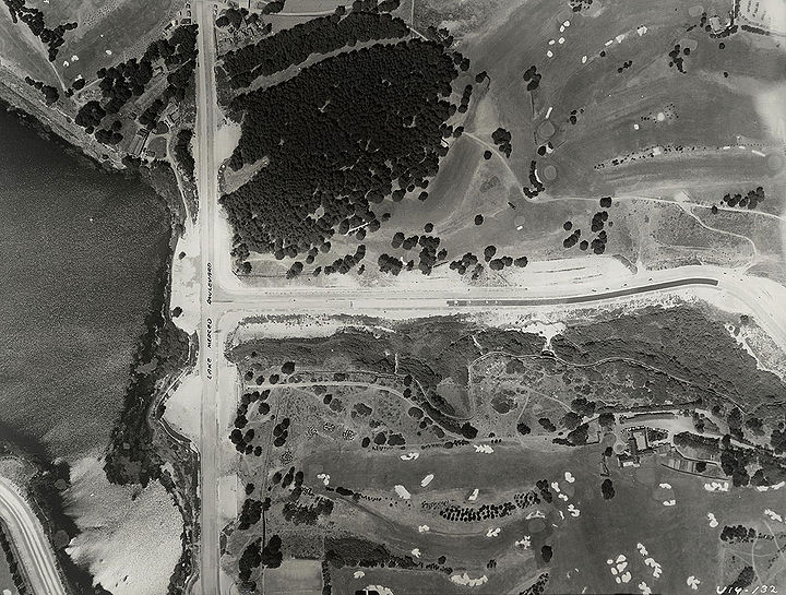
Aerial shot in 1938 looking down on Brotherhood Way where it connects to Lake Merced Drive, photo by Harrison Ryker.
Photo: San Francisco History Center, San Francisco Public Library, courtesy DavidRumsey.com
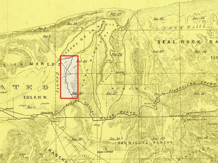
1861 Wackenruder map of gully that later becomes Brotherhood Way.
Map: courtesy DavidRumsey.com
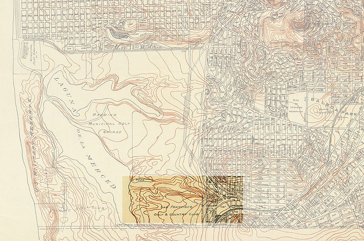
1929 Board of Public Works map showing gully that five years later was altered by WPA project to create Brotherhood Way.
Map: courtesy DavidRumsey.com
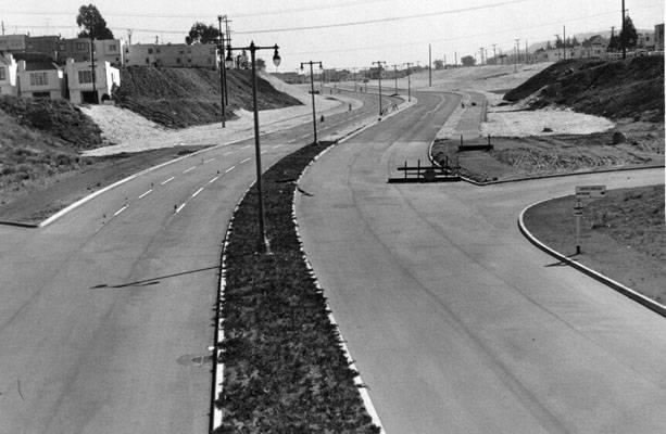
Stanley Drive (later Brotherhood Way) linking Alemany and Lake Merced Blvds., April 2, 1953.
Photo: San Francisco History Center, San Francisco Public Library
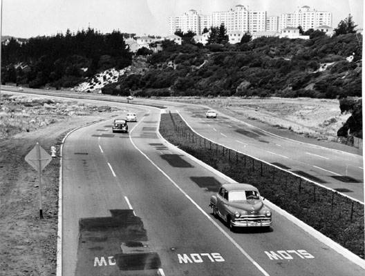
Brotherhood Way between Junipero Serra and Lake Merced boulevards, June 10, 1961.
Photo: San Francisco History Center, San Francisco Public Library
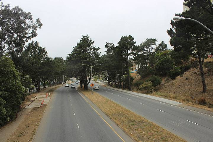
Brotherhood Way looking west from Chumasero Drive, 2014.
Photo: Chris Carlsson
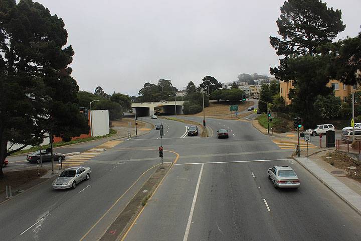
Brotherhood Way at intersection with Charles Avenue, Junipero Serra crossing on overpass in distance (looking westward), 2014.
Photo: Chris Carlsson
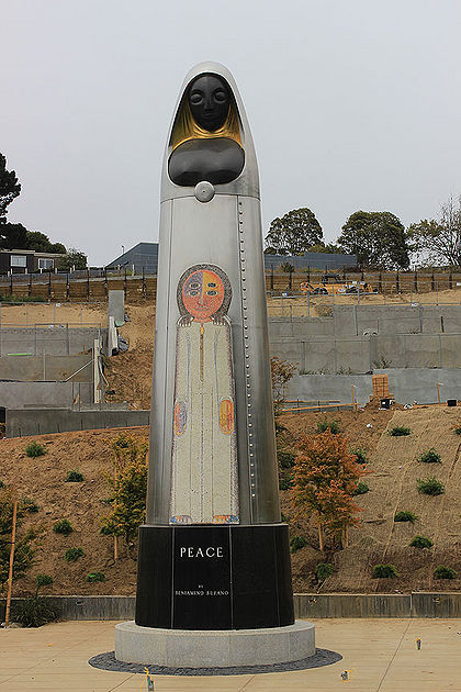
One of many Beniamino Bufano sculptures around San Francisco, this one on his favorite topic: Peace, installed along Brotherhood Way.
Photo: Chris Carlsson
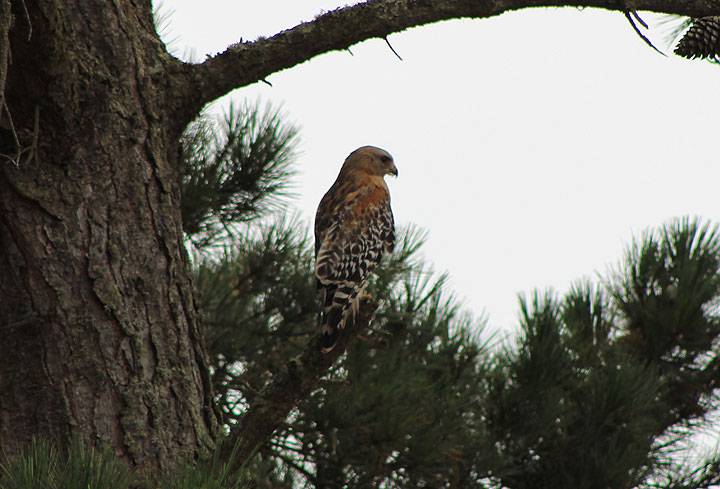
Amidst what was once sand dunes and a creek gulley, today are many Monterey Pines and other introduced tree species, which in turn have attracted wildlife that didn't have much habitat in this area once upon a time.
Photo: Chris Carlsson

