Produce Market
Historical Essay
by Chris Carlsson
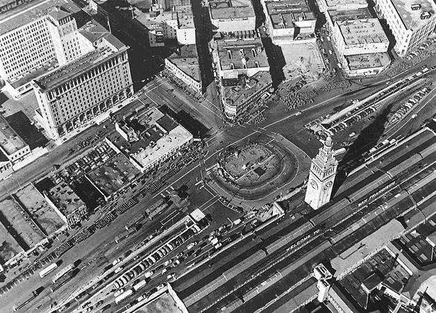
The old produce market once occupied part of today's downtown, the areas near the docks stretching northward from the Ferry Building. You can see the low-rise buildings going off this 1947 photo to the top and right (west and north), and the produce market started right in that area. More photos below.
Photo: Private Collection, San Francisco, CA
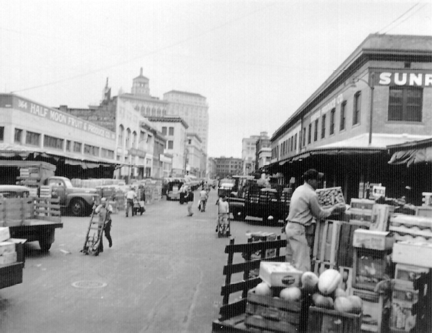
The Produce Market occupied a couple of dozen square blocks of land adjacent to the northern waterfront, east and slightly north of the downtown financial district. It became the first prominent project of the Redevelopment Agency ultimately leading to the complete removal of the industry that had long been at the heart of San Francisco's Italian community.
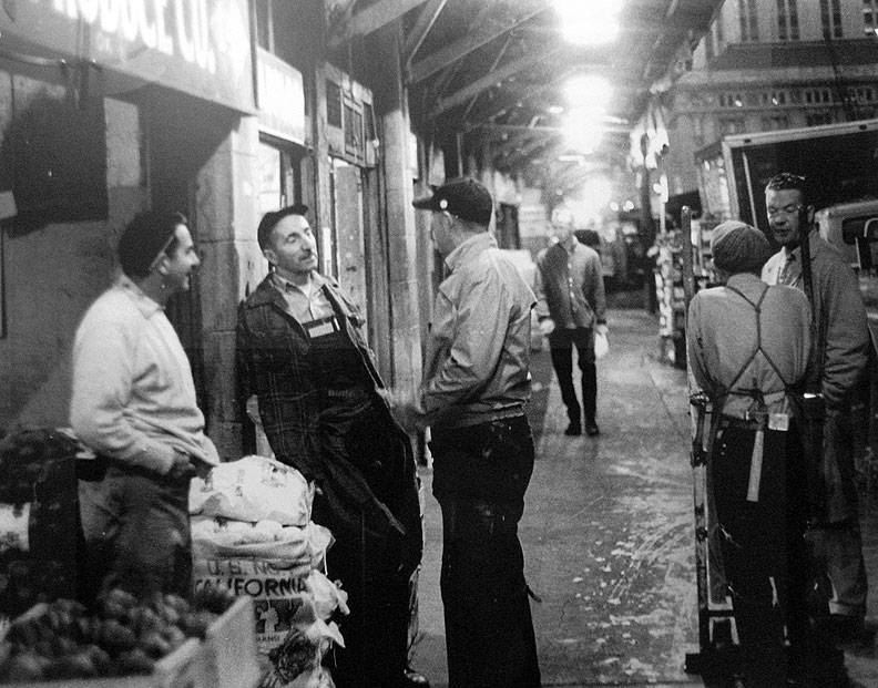
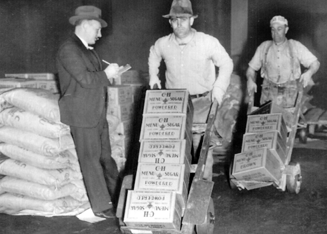
Produce market workers sharing some early morning stories, c. 1950.
Photo: Shaping San Francisco
As Alison Isbenberg details in her important book Designing San Francisco: Art, Land, and Urban Renewal in the City by the Bay (Princeton University Press: 2017), the neighborhood's suitability for a modernizing redevelopment project depended on selling city streets at a fraction of their actual value. This discounted transfer of property went hand in hand with the clearance of land and property rights using the Redevelopment Agency's power of eminent domain, and then subsequent sale of that same land to private investors at far below their market value.
77.7 acres were identified as potentially available for the site. Of these 77.7 acres, a staggering 46 acres consisted of existing streets. The proposed redevelopment parcel converted 21 acres of former streets into buildable land for development by paring down 46 acres of former streets to 24.9 acres for new streets. Thus 21 of the plan’s projected 52.8 net available acreage came from former streets.
Within months of [Justin] Herman’s hiring, the SF Redevelopment Agency was buying properties, clearing parcels, and selling land. Herman’s leadership was credited, and blamed, for mobilizing the city’s three redevelopment projects: the Western Addition, based on a controversial neighborhood clearance; Diamond Heights, a middle-income residential project on vacant land; and, of course, the Golden Gateway, which required demolishing the produce market and its surrounding low-density commercial district.
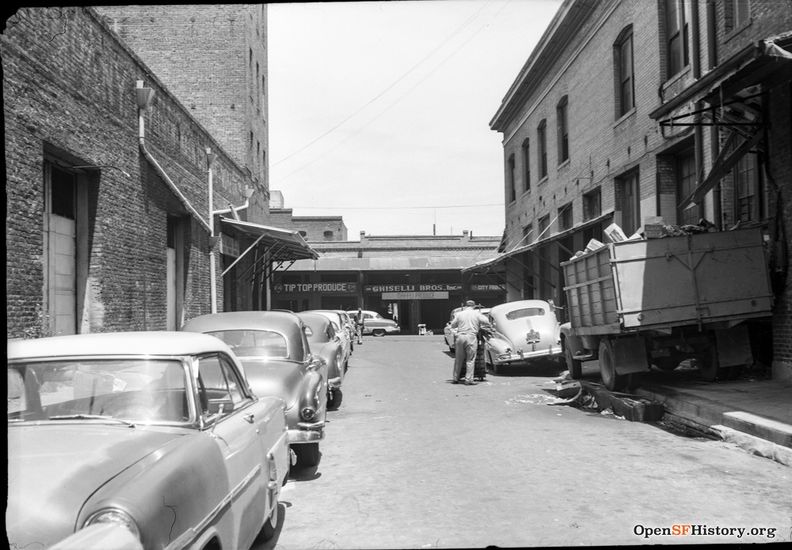
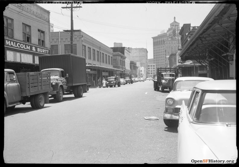
One of the streets demolished to make way for One Maritime Plaza was Ceylon Street, here looking north along its one block from Clay to Washington between Davis and Front Streets, seen here in May 1959.
Photo: OpenSFHistory.org wnp28.2419.
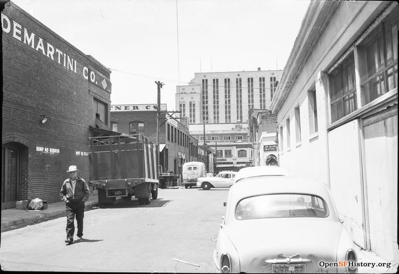
Another lost street to redevelopment, Oregon Street looking west, between Washington and Jackson Streets. You can see the ICE building (it was known then as the Appraisers Bldg) and the backsides of DeMartini Co., and Levy & Zentner Co. at left (scroll to bottom to see front of Levy & Zentner Co.)
Photo: OpenSFHistory.org wnp28.1202.
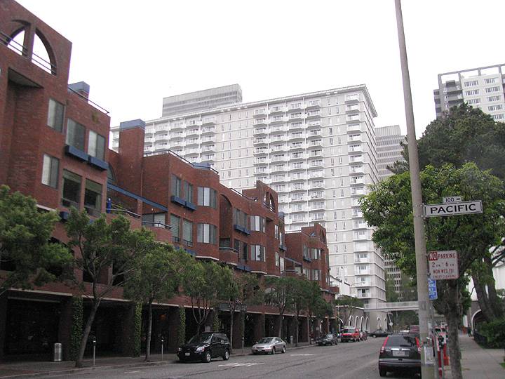
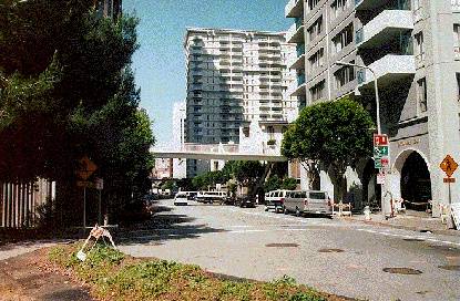
Golden Gateway Apartments towering over more recent, smaller-scale offices and condos along Davis at Pacific, built over the old Produce Market site.
Photo: Chris Carlsson, 2011
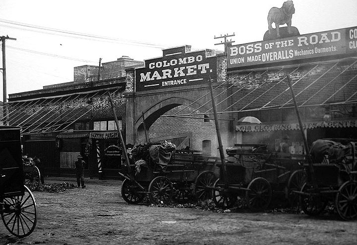
Colombo Market, c. 1920s
Photo: California Historical Society
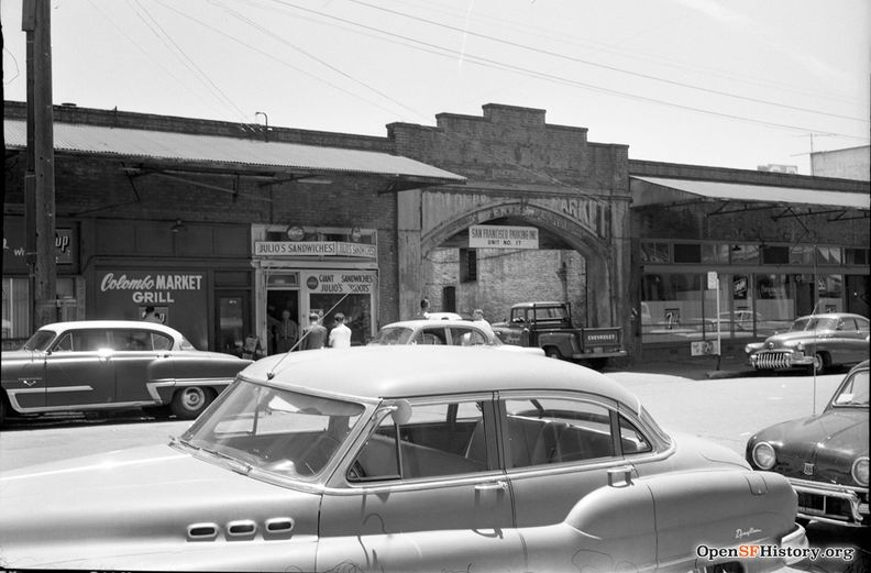
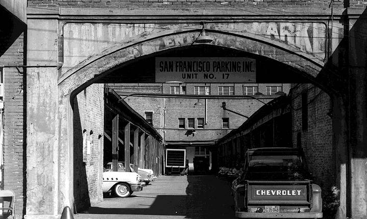
Colombo Market Arch, Front Street between Jackson and Pacific, 1959.
Photo: OpenSFHistory.org wnp28.2474
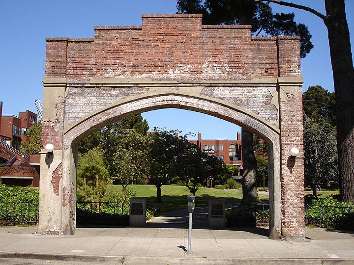
The old Colombo Market gate, still standing today as an entry arch to the park.
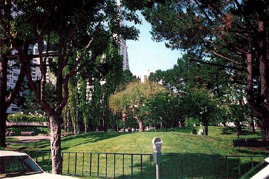
The old Colombo Market gate, recently relieved of its ivy covering, standing alongside Sydney Walton Square, the private/public park of the Golden Gateway Apartments.
Photo: Chris Carlsson
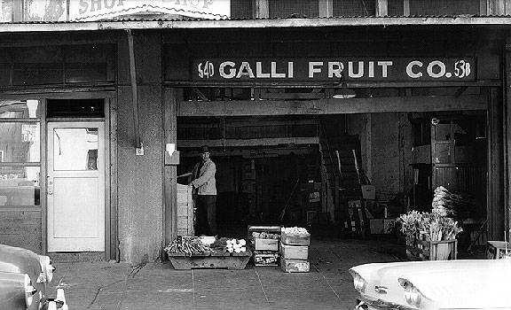
Galli Fruit Company
Photo: C.R. Snyder
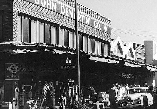
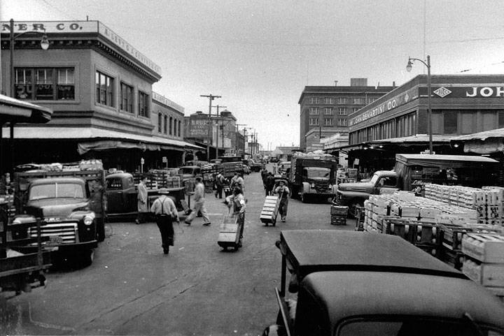
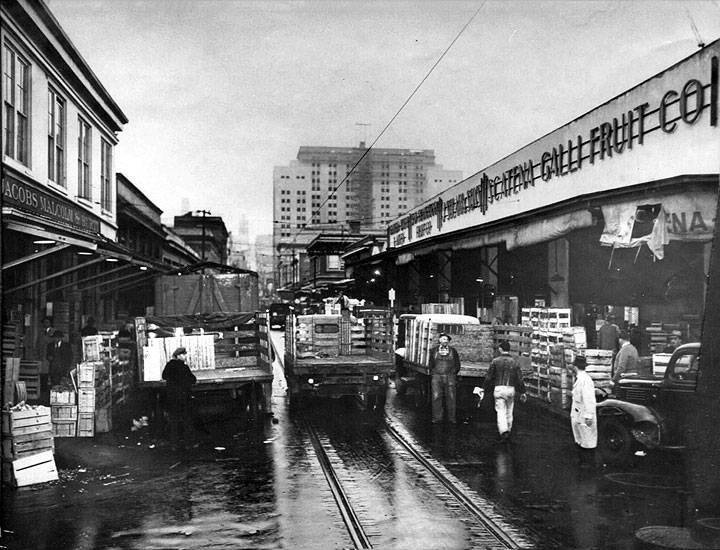
Produce Market at Washington and Davis Streets, mid-1950s.
Photo: C.R. Snyder
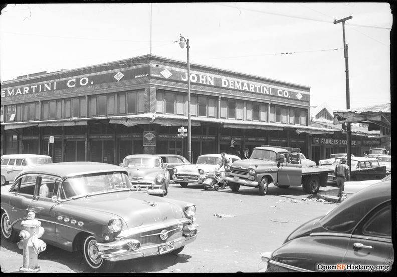
May 1959, Davis and Washington Streets.
Photo: OpenSFHistory.org wnp14.11135
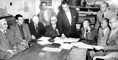
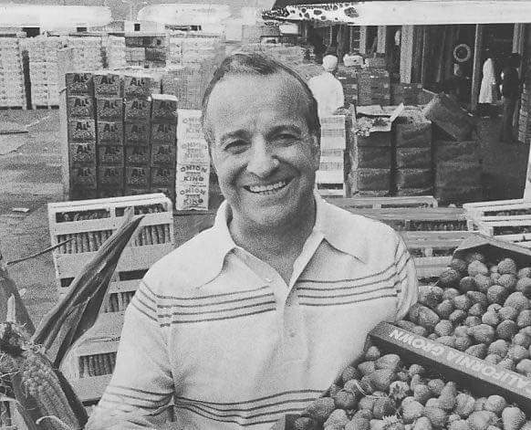
These are the produce market owners who tried to fight the city's redevelopment plans for the site of the market. Joe Carcione is the young man 4th from the left, who later became TV's Greengrocer.
Photo: San Francisco History Center, SF Public Library
Joe Carcioni during his "salad days" as a TV Greengrocer.
Photo: provenance unknown, via Facebook
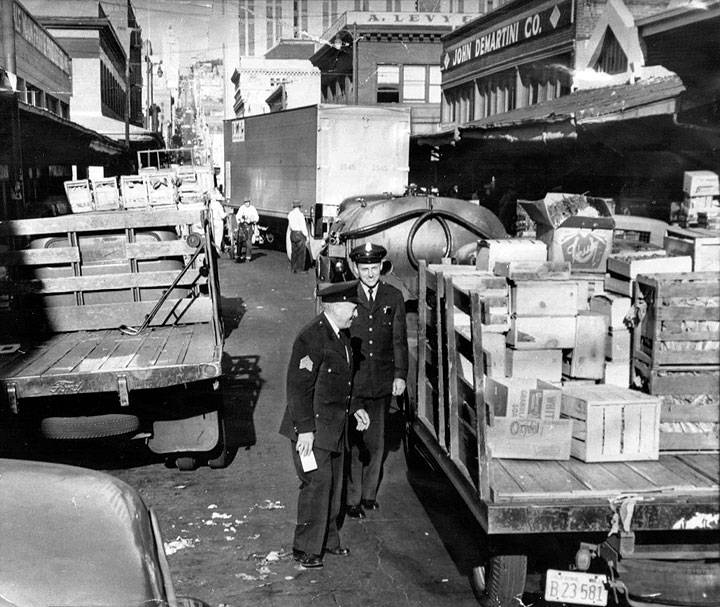
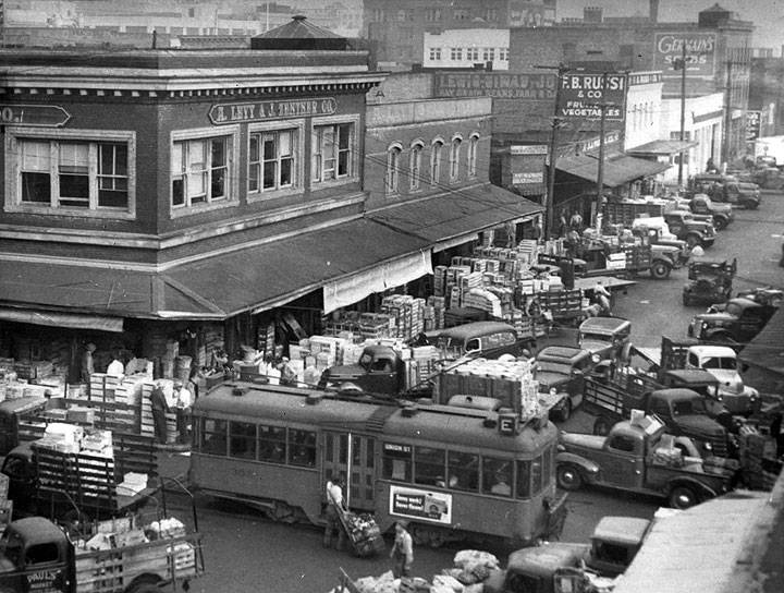
One of the main arguments in favor of moving the old produce market was that the streets were so clogged with vehicles that it led to the wastage of large quantities of fresh produce.
Photos: San Francisco History Center, SF Public Library
Looking south on Davis near Washington. The tall building in distance with the cupola style top is the Matson Building, while the one next to it on the right is the Pacific, Gas and Electric Building. Today this view is blocked by the Embarcadero Center and other highrises.
Photo: San Francisco History Center, SF Public Library
June 1959 view south on Drumm Street across Washington towards Market Street.
Photo: OpenSFHistory.org wnp14.10237
In these days the old produce market was the heart of Italian San Francisco, dominated by families from Genoa and the Italian-speaking canton of Switzerland, Ticino. Local Italians led the founding of the Farmers' Market in 1943 at Market and Duboce, in part to overcome bottlenecks in distribution of locally grown produce during WWII.
Photo: San Francisco History Center, SF Public Library
Dozens of 1- and 2-story warehouses characterized the district, long forgotten in the 21st century where the Embarcadero Center and surrounding rehabilitated buildings full of architectural firms, lawyers, restaurants, and other modern uses.
Photo: San Francisco History Center, SF Public Library
View westward on Washington from apx. Davis in the mid-1950s.
Photo: San Francisco History Center, SF Public Library
Same view west on Washington of the Golden Gateway Apartments and the edge of the INS building (center rear). This was the former site of the downtown produce market.
Photo: Chris Carlsson, 2007
The former site of the produce market in downtown is now a modern office development and the small park area.
Photo: Chris Carlsson
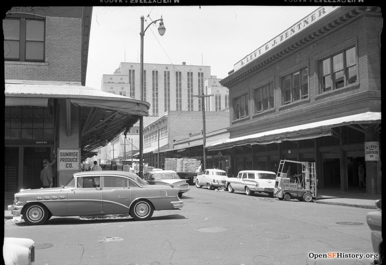
May 1959 looking west on Washington Street. Levy & Zentner Co. at right.
Photo: OpenSFHistory.org wnp14.11134
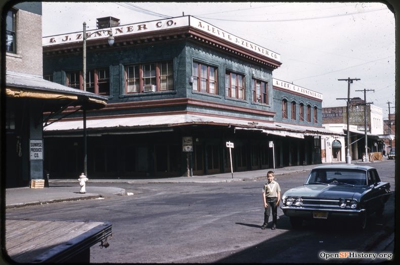
1963 view in color of Levy & Zentner at the northwest corner of Davis and Washington Streets, not long before demolition.
Photo: OpenSFHistory.org wnp25.0261
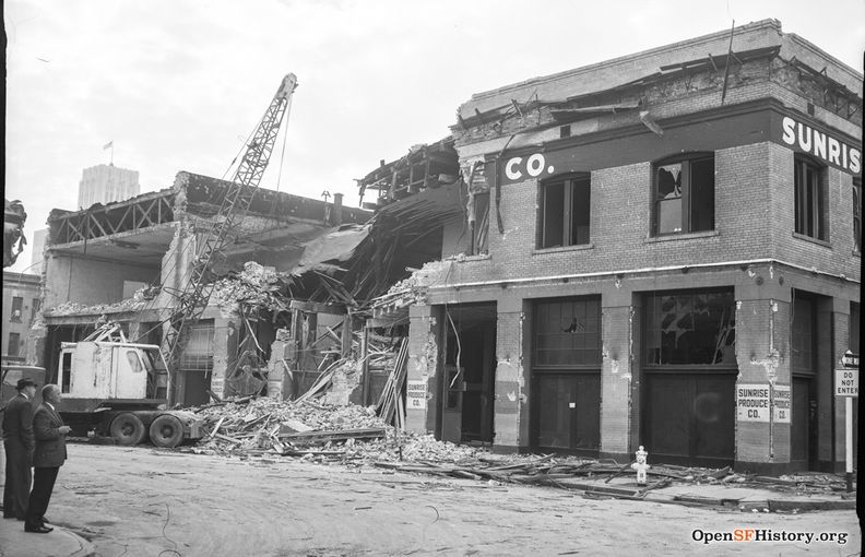
November 1963, intersection of Washington and Davis again, now being demolished to make way for the Golden Gateway Redevelopment Project.
Photo: OpenSFHistory.org wnp14.10490
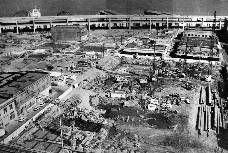
1963 aerial view of the Redevelopment zone that became the Embarcadero Center and the Golden Gateway Apartments, built over the carcasses of the old Produce Market, with the Embarcadero Freeway at top of image.
Photo: San Francisco History Center, SF Public Library
<iframe src="https://archive.org/embed/old-produce-market-1930s-llsf-2016-20-mbps-1" width="640" height="480" frameborder="0" webkitallowfullscreen="true" mozallowfullscreen="true" allowfullscreen></iframe>
It begins with a drive up Washington to Davis Street through the old Produce Market in the 1950s, turning north on Davis as the camera looks south from the back of the moving vehicle. Then we meet a "Produce Market Lumper" who describes his work and daily routines, ending at his home somewhere on the west side.
Video: from "Lost Landscapes 11" courtesy Prelinger Archives.

