Point Lobos to Geary—Early 20th Century: Difference between revisions
(changed category from Richmond to Richmond District) |
(changed photo caption per user correction) |
||
| Line 16: | Line 16: | ||
[[Image:Geary-West-at-22nd-Ave-1927-SFPL.jpg|720px]] | [[Image:Geary-West-at-22nd-Ave-1927-SFPL.jpg|720px]] | ||
'''Geary Blvd. west at | '''Geary Blvd. west looking at the intersection with 23rd Avenue, 1927.''' | ||
''Photo: San Francisco History Center, SF Public Library, courtesy Charles Ruiz collection'' | ''Photo: San Francisco History Center, SF Public Library, courtesy Charles Ruiz collection'' | ||
Revision as of 09:38, 22 March 2015
Unfinished History
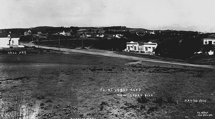
Northwesterly view from 31st Avenue near Geary (then Point Lobos Road), with cemetery visible at Lincoln Park, May 30, 1900.
Photo: San Francisco History Center, SF Public Library, courtesy Charles Ruiz collection
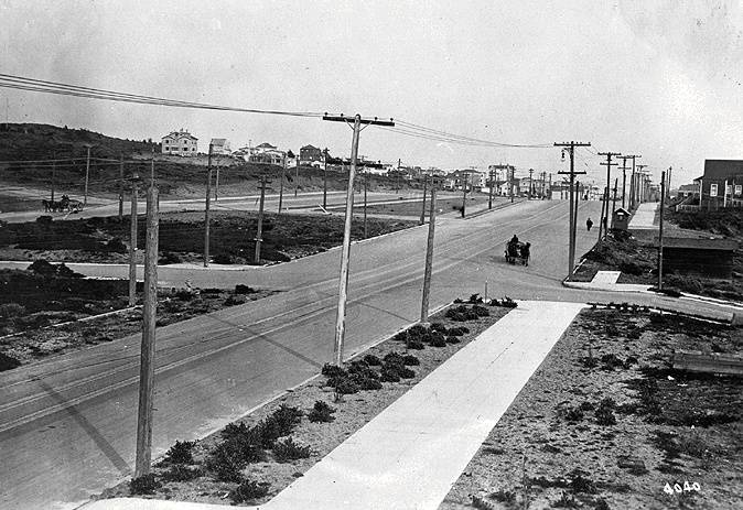
Looking east at the intersection of Geary and 43rd in 1917. Horse and buggy travel was still common at the time. To the left of Geary is Point Lobos.
Photo: Private Collection, San Francisco, CA
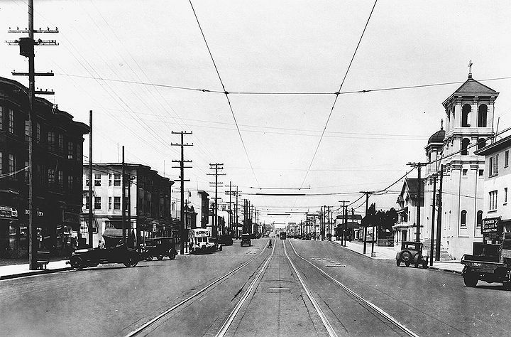
Geary Blvd. west looking at the intersection with 23rd Avenue, 1927.
Photo: San Francisco History Center, SF Public Library, courtesy Charles Ruiz collection
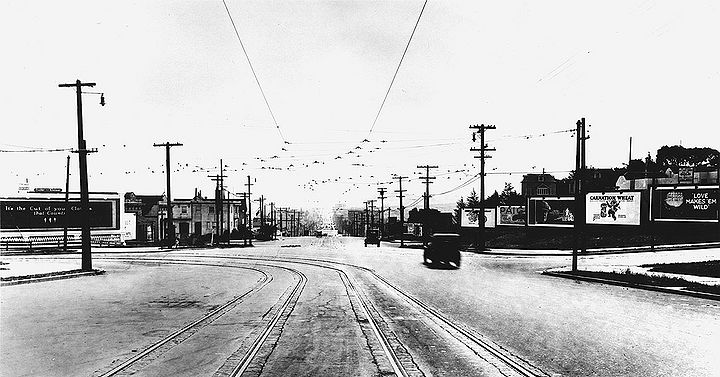
Geary Blvd. east at 33rd Avenue, 1927.
Photo: San Francisco History Center, SF Public Library, courtesy Charles Ruiz collection'


