Old Cemeteries in the City
Primary Source
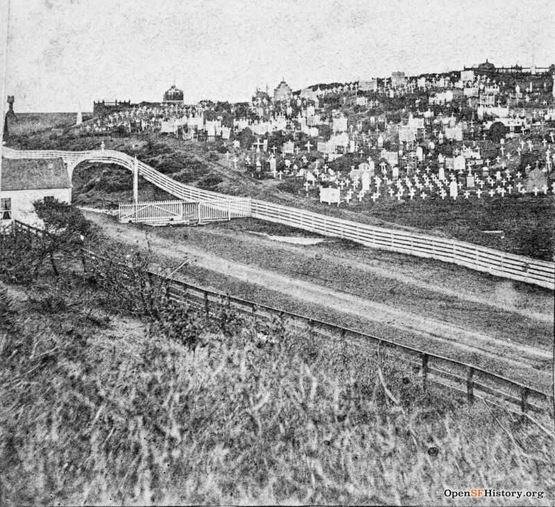
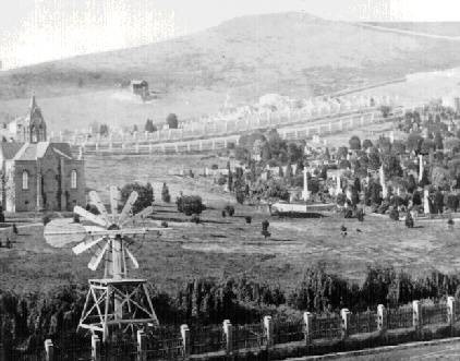
Pt. Lobos Road now Geary Street near Presidio Avenue; tollhouse, graves in background Calvary Cemetery, 1860s
Photo: OpenSFHistory.org wnp37.01364
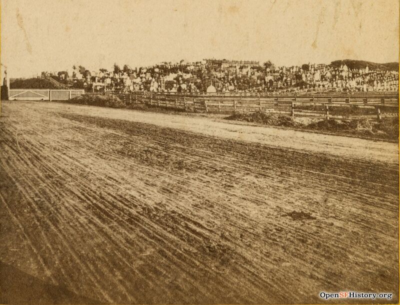
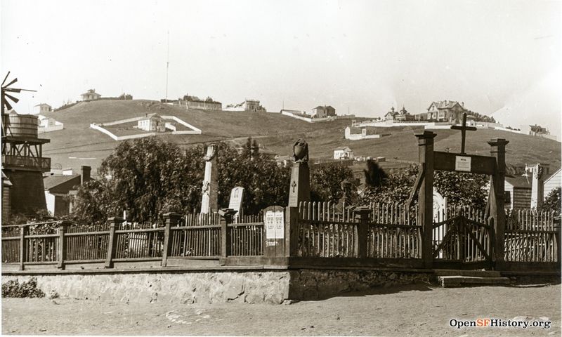
View east of Calvary Cemetery (Roman Catholic) gravestones crosses, fence, and gate for the Point Lobos toll road, Geary near Masonic, 1870s.
Photo: OpenSFHistory.org wnp24.0153a
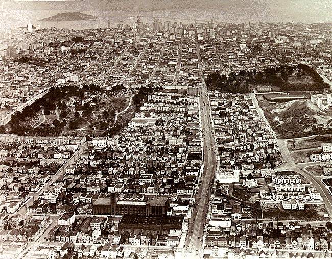
Bird-eye view of the Richmond District, looking east in 1938. The Columbarium is the round structure, lower right.
Photo: Private Collection, San Francisco, CA
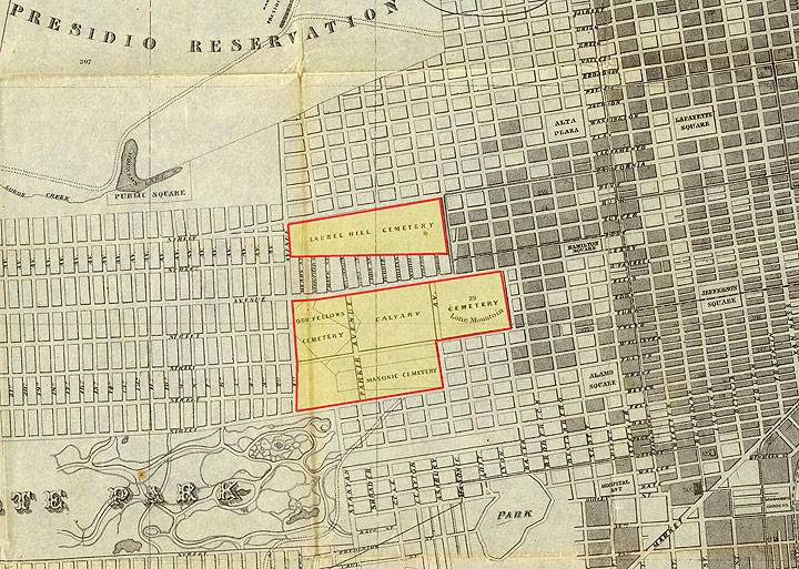
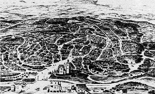
Big Four Cemeteries seen here on 1870 map.
Map: Courtesy David Rumsey]
The Jewish Cemetery at what is now Dolores Park in the Mission
pre-1850 Vacant lots were used for impromptu burials: Russian Hill (Jones & Vallejo); Clarke's Point (eastern side of Telegraph Hill); 1st & Clementina; North Beach (near Powell & Lombard)
1850 Yerba Buena Cemetery opens (8th & Market), site of former City Hall and future main library.
1854 Jewish Cemetery (Cow Hollow bounded by: Franklin, Gough, Broadway & Vallejo Sts.)
1860-61 Jewish community establishes [[|two cemeteries: Nevai Shalome & Gibbath Olom (now Dolores Park)
1850s: Early San Francisco Cemeteries: Mission Dolores. Russian Hill. Telegraph Hill. North Beach, Yerba Buena, and Presidio.
The Mission Dolores Cemetery, c.1880.
Photo: OpenSFHistory.org wnp4.1779a
1854: Laurel Hill Cemetery developed.
Late 1850s: Yerba Buena Cemetery abandoned.
1860: Calvary Cemetery, the Catholic Cemetery, developed on Lone Mountain.
1864: Masonic Cemetery developed.
1865: Odd Fellows Cemetery developed.
1880s: The cry "Remove the cemeteries!" began.
1887 Catholics establish Holy Cross Cemetery in Colma. On June 7, Timothy Buckley is the first to be interred in Colma.
1888 Jews establish Home of Peace Cemetery in Colma for bodies evicted from what is now Dolores Park.
1889 No more burials in Jewish cemeteries.
1889 Jews establish Hills of Eternity Cemetery.
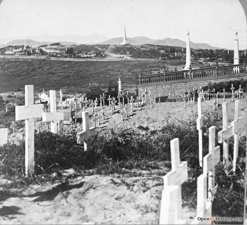
Laurel Heights Cemetery during the 1890s, sprawling into the sand dunes of the Inner Richmond area.
Image: Private Collection, San Francisco, CA
1900: Most graveyards filled. Cemeteries deteriorating.
1900 Mayor James D. Phelan signs the order "prohibiting the burial of the dead within the city and county of San Francisco after the first day of August 1901."
1901 Board of Supervisors get permission to use City Cemetery as a park to raise Richmond property values.
1913 Board of Supervisors ordered all cemeteries closed and bodies removed. Voters overturned the ordinance.
1921: State legislation passed to allow cemeteries to be abandoned. Litigation followed.
1923: Second Morris Act passed allowing removal of bodies from cemeteries.
1924 City of Lawndale, later Colma, incorporated by the Associated Cemeteries.
1920s: Masonic and Odd Fellows Cemeteries' remains removed to Colma.
1920s: "Franciscan Heights" subdivision developed on Odd Fellows land. University of San Francisco purchased Masonic cemetery land. Jordan Park developed.
1927: St. Ignatius College moved to Fulton and Parker Streets.
1930: St. Ignatius renamed the University of San Francisco.
1930s: Removal of Laurel Hill and Calvary encouraged. Several plans discussed but had little support.
1932: San Francisco College for Women built on Lone Mountain.
1937: Catholic Archdiocese ceased opposition to removal of Calvary.
1937 Supervisors again ordered the "disinterring and removal of human bodies." Voters upheld the ordinance this time.
1939 Exhumations begin, not completed until 1948.
1941 The post office requires Lawndale to change its name, due to another post office by the name of Lawndale in Los Angeles County. Lawndale becomes Colma.
1930s/1940s: Removal of Laurel Hill and Calvary remains to Colma.
Calvary Cemetery after being cleared for redevelopment, August 26, 1946.
View northwest from Calvary Cemetery, roughly at O'Farrell east of Masonic. Point Lobos Road (later Geary Blvd.) in middle distance. The large monument in the distance is the memorial to Senator David Broderick.
Photo: courtesy OpenSFHistory.org wnp37.04005-L
Photo: San Francisco History Center, SF Public Library
<iframe src="https://archive.org/embed/lone-mountain-cemeteries-w-woody-la-bounty-oct-28-2023" width="640" height="480" frameborder="0" webkitallowfullscreen="true" mozallowfullscreen="true" allowfullscreen></iframe>
Woody LaBounty leads a walking tour of the old cemeteries of Lone Mountain, October 2023.
Video: Shaping San Francisco
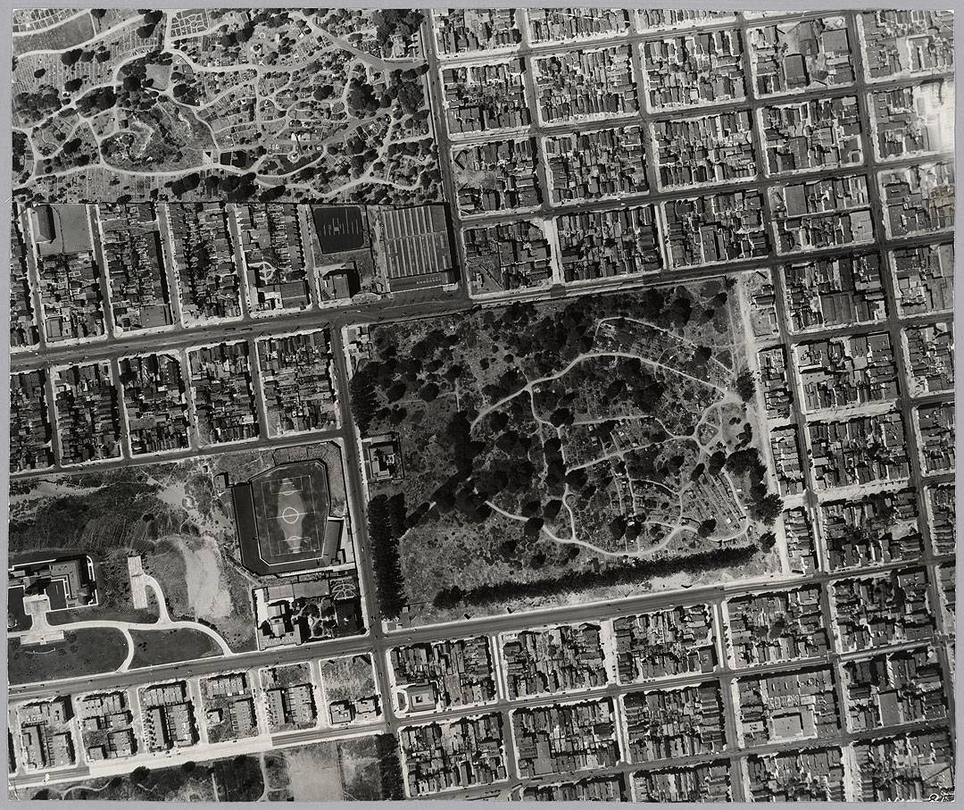
Aerial view in 1938 of the Calvary and Laurel Hill cemeteries before their removal.
Photo: courtesy David Rumsey collection
1940s/1950s: Development of Laurel Heights with residential homes and apartments.
1964: University of San Francisco became co-educational.
1978: University of San Francisco acquired Lone Mountain campus.
1980s: Columbarium renovated under ownership of Neptune Society.
1988: St. Ignatius High School torn down. Koret Recreational Center built.
1993 Excavation for the rebuilt Legion of Honor Museum at Land's End uncovers at least 700 bodies. There are many more still buried at Land's End.
more information is available from Trina Lopez's excellent documentary, "A Second Final Rest"
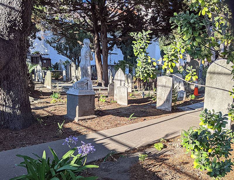
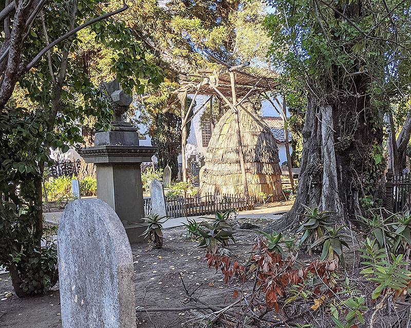
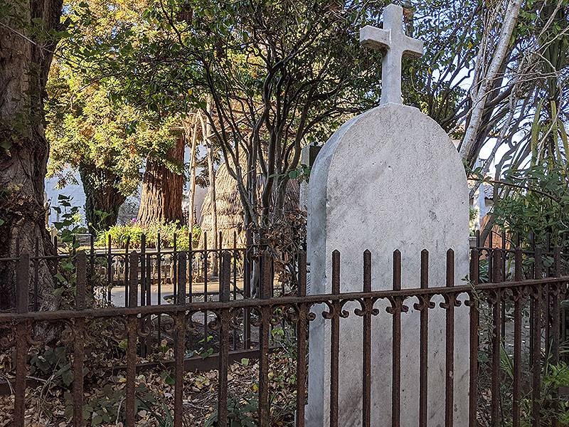
Three photos from the last remaining cemetery in the City at Mission Dolores, 2021. The recreated Ohlone hut is a gesture to the enormous wave of death that swept through the original inhabitants of the peninsula within a few short years of colonization.
Photos: Chris Carlsson

